
Only a few weeks ago I published a report about a day trip I took with friends to Tahsis Mountain. In that post, I described a route up the east side of the range from Malaspina Lake to what we hoped would be the summit, and the problems we had in determining which bump was our goal. Since that time, I’ve also learned of another issue that confuses my assessment: the peak listed in Island Alpine is the highest point in the range but not, in fact, the summit named in the province’s database. We definitely didn’t summit Tahsis Mountain on that first trip, so on June 2nd, we made a second attempt.

Looking north toward the summit from the first bump on the end of the ridge.
Rather than repeat the errors of the first trip, we used a route that follows the south ridge from a spur off Tsowwis Main, a route likely used by Lindsay Elms (Island Bushwhacker, p. 33, 2006). Having used this logging road for our summit of Santiago Mountain, we were familiar with it, and had an inkling of what to expect.

Tahsis Mountain via South Ridge Route
Total Distance: 15.4 km
Starting Elevation: 484 m
Maximum Elevation: 1317 m
Total elevation gain: 1272 m
Total Time 10 hours
http://explorington.com/2019/06/tahsis-mountain-via-the-south-ridge/
The familiar sections of the road passed quickly, and before long, we were heading north into a screen of green. Although it looked nearly impenetrable, once we forced our way through the curtain, we discovered a very rough game trail that guided us along the razed (probably dynamited) spur. Evergreen branches close to an inch thick, alder, and salmonberry bough obscured many sections of the route. Impossible to tell left from right, I relied on the weight of my body to push a course through, or duck under the branches. Within an hour we had cleared the lower section, and after missing the turn once because we couldn’t see the spur, we found our way onto the upper road where the bush cleared.

enjoying the sun toward the end of the road
The clear road didn’t last long, and soon we were rounding the corner (~780 m) into the thickest patch of young alder I’ve ever seen. Our backpacks, limbs, and even our heads got hung up in the tightly-packed saplings; it was impossible to finesse my way through. After about two minutes, I was ready to get the heck out of there. Rather than fight to the end of the road, we decided to fight our way up the logging slash straight to the old-growth just 40 metres above us, even though this meant fighting through shoulder-high shrubs and re-growing forest.

Phil and Dustin turn their way through some of the less bushy sections
The intense bushwhack soon ended, with us on the edge of the old-growth. Though I’m sure it would be possible to find some fun on the bluffs, we managed to keep it to class-two with some simple third-class to save detouring. At worst, we used small sections of karst covered in thick intertwining tree roots and shrubs, all of which combined to create a pretty easy route up to the top of the ridge.
On the ridge, we took some time to stand atop the southernmost bump to look at the route ahead and discuss our goals. The ridge stretched north ahead of us, each of the bumps standing prominent on the ridge. Even after escaping the forest, the humidity was high, making the effort of the climb noticeable. I think everyone was happy to stand and “discuss the route options” at any chance they could.

Santiago Peak high above Tahsis Inlet.
From the end of the ridge, we dropped over onto the west side and traversed there until we hit a saddle and crossed back to the east. We took care not to drop too far off either side, and managed to keep to steep class-two terrain. We could often see the highpoint ahead, and for purposes of navigating, we dropped to the east side below the bump, just south of the highpoint, but only after trying to climb straight over it.

Ridge rambling!
We regrouped in the narrow saddle, between the two highest points. Dustin and Phil were waiting for us, and as they did, the weather shifted. Instead of muggy sunshine, a cold, wet wind blew clouds in. As we ascended the final slope to the top of the peak, more weather blew in. By the time we reached the summit, a thick soup of cloud had welled up and obscured the valleys, with just the highest points of the mountain peeking above.

Anne enjoying her break on the summit.
We reached the summit of Tahsis Mountain (at least where Island Alpine and Google place it) at1:30 pm. From the peak, it was possible to see the ridge stretching north. We could also see the place we’d stood a few weeks earlier, not even two hundred meters away, and between it and us a single rocky pinnacle, the bump marked by the provincial database as the true summit; as yet, unclimbed by me.

what is likely the true summit in the foreground, and beyond where we visited on a previous hike
I felt restless, perhaps due to knowing that I was leaving that bump unclimbed, or maybe the few tiny raindrops that started to fall. My mind drifted to how grateful I was that our route was dry, and then over to what a show it was going to be to descend through the wet bush.

scrambling up to the sub-summit
On our return, we mostly stuck to our ascent route, though Ramsay and I absconded momentarily to gain another bump –just a ten-minute detour up a debris-laden slope to the ridge, less than forty metres elevation from our original route. How could we not?

the ramp coming off the ridgetop
In the few minutes since leaving the main summit, the weather cleared, so we were able to see clear down the Tahsis Inlet to the town. We knew the others were waiting, so we didn’t delay long. We followed the narrow ridge –in places, it was only a foot wide and dropped steeply off on either side. At the end of the ridge, we used a narrow, exposed ramp hidden under a shrub to scale down the final few meters to rejoin our friends, just beyond the end of the ridge and back on route.
Travelling as a group, we traversed the remaining ridge and down the south-facing slope toward the road. By this time, the forest was wet from the light drizzle, and though not enough to make me feel wet, it made every stick and log a slippery step.

The face of success
As for the overgrown logging road, the water didn’t help any. The route was now a wet, slippery mess of tangled branches in living plants. The water probably greased us up a little bit, allowing us to pass through more easily, but in exchange, I was soaked. The water ran down my leg and filled my boots, and the pine needles that collected between my back and bag were somehow washed into my pants (a fact I discovered later at home when I stripped to get into the shower). By the time we reached the open road, water was oozing from my boots, the sloshing audible as I walked the road back to the Jeep. Being in the lead, I got the worst of it; somehow, Dustin had dry spots on his pants and t-shirt.

Sweet freedom!
As for ticking Tahsis Mountain from my list of peaks, I’m doing it. Atop the mountain when I checked the elevation, it matched the data in Island Alpine. So, regardless of the position of the correct peak, which I’ll concede is probably still unclimbed, I’ve hit the summit in the book.
See all the images from this trip
-

- Anne coming up the ramp to the main summit

-

- Looking south from the main summit along our route

-

- a tangle of roots

-

- a short break before heading back into the overgrown road.

-

- scrambling up to the sub summit

-

- Our route would pass on the right side of that bump

-
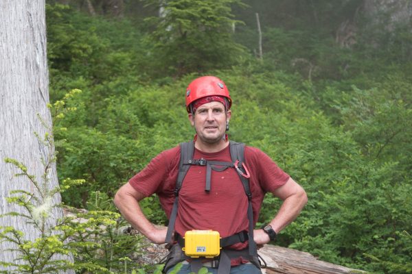
- Man Pretty!


-

- the razed road; yes, “road”.

-

- Ramsay, yes, we did it

-

- Looking north toward the summit from the first bump on the end of the ridge.
Share this Post