I’m a prisoner to my work schedule, and my summer vacation kicks off in the final weekend of June. However, since meeting Phil, I’ve come to participate in an annual pre-summer trip known as the Birthday Hike. This annual prelude-to-summer trip has brought us to some of the best places on Vancouver Island.

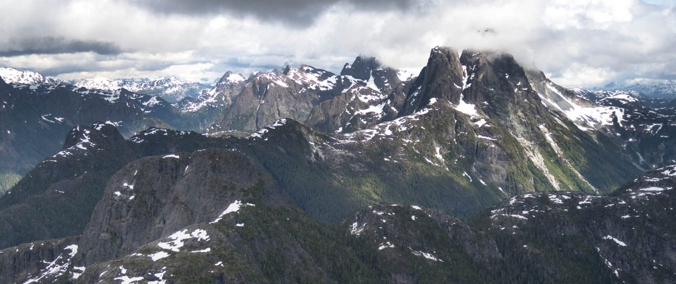
Wolf Mountain
For two days, starting June 22, 2019, we set our sights on the three peaks which rise high along the ridge, on the west side of the Elk River Trail. The ridge is among the best Island Alpine I’ve had the pleasure of hiking; its near-pristine nature is protected by the awful bushwhack of Butterwort Creek on one end and a gnarly few steps on the other. It’s the type of terrain that is only visited by the crazy few who would seek out these diminutive objectives over the many giants of the Elk River Valley.
Total Distance 28.6 km
Starting Elevation: 312 m
Maximum Elevation: 1826 m
Total Elevation Gain: 2421 m
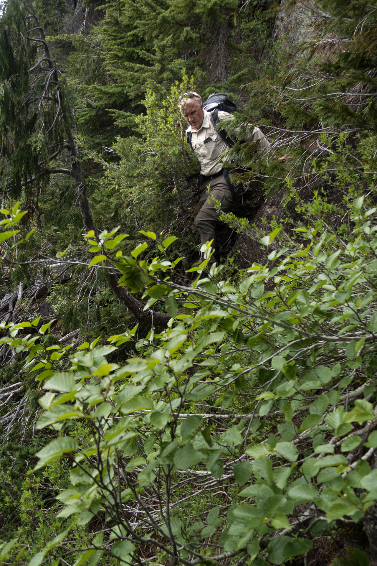
Our group of three headed up a prominent rib from the Crest Creek Crags Day Use area, the standard route. The most challenging navigation came shortly after our start, finding the route up from the climbing area! Once we got on track, we found the lightly-booted and sparsely-flagged route easy enough to follow.

Hiking up through the forest
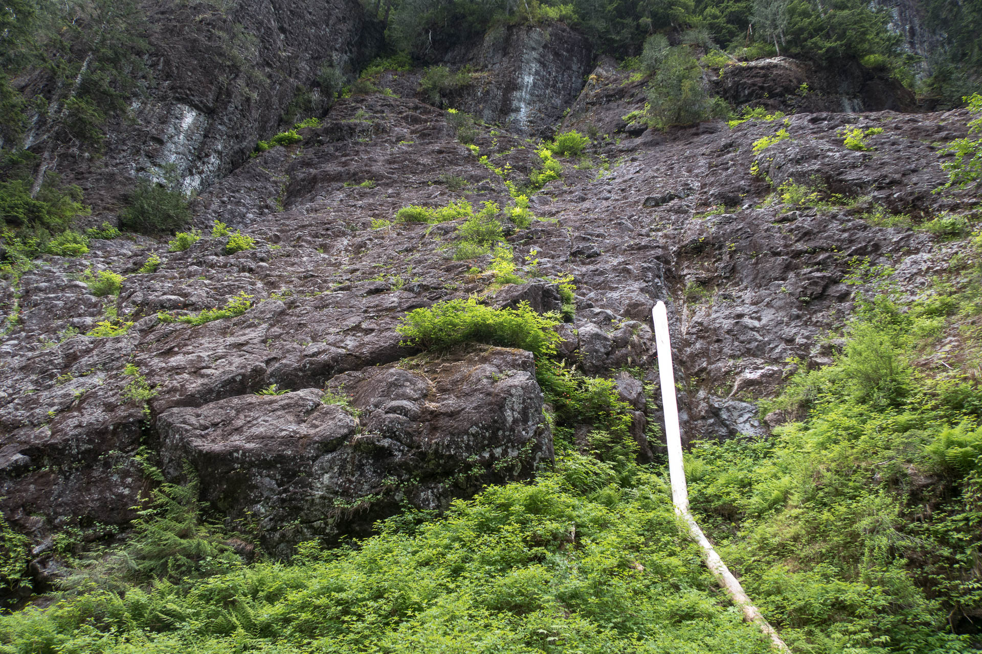
The very light flagging provided enough prompts to encourage us along the right track, and funneled toward a narrow part of the ridge, right below the climb up. The geography of the area forces everyone through this single point (49.82345, -125.90703), and still it has little evidence of substantial traffic.

It’s mountaineers only beyond this point; most hikers will turn back because it’s simultaneously bushy, scrambly, and exposed, and requires the nerve to put your life in the hands of a vegetable as you creep along the ledges to reach the ridge. We worked our way up the bushy gully and then out onto a bushy but exposed ledge, and one short step that made me grateful for the dry conditions– I’m thankful for the bushes to use as a hold.

the small step
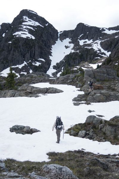
Once above the step, we left the bush behind in favour of the easy navigation of more open terrain. Within four hours we gained 1150 metres and reached the first highpoint on the ridge. The noonday sun shone hot, prompting us on toward the finally visible Wolf Mountain.
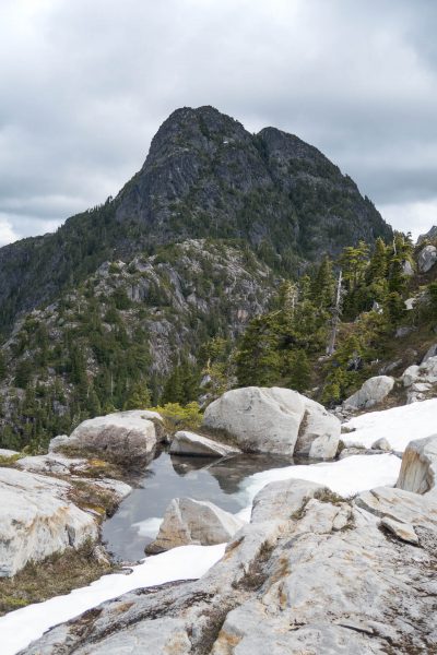
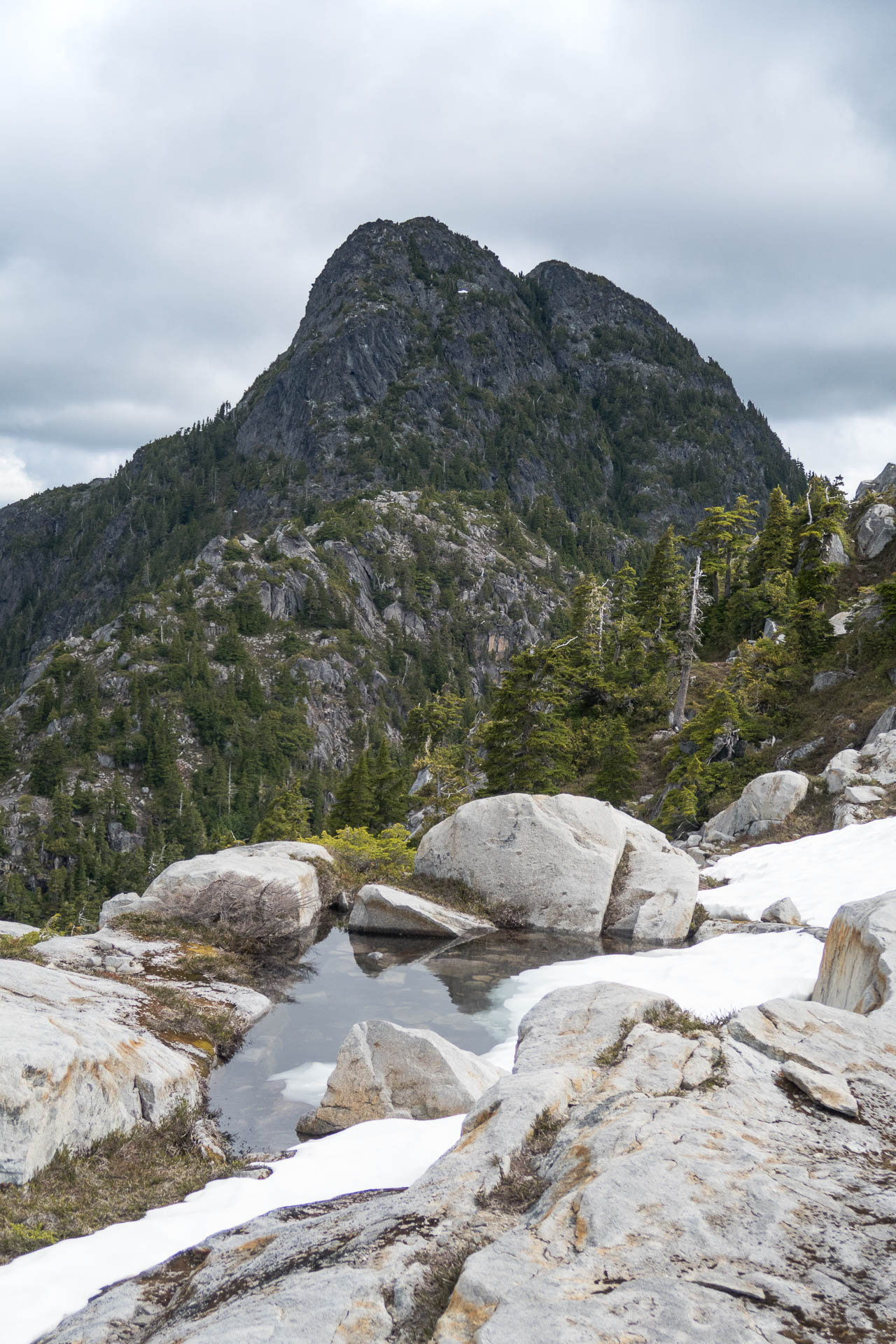
Wolf Mountain
When we spotted the large, still-snow-covered lake below the peak, we evaluated our options and decided to make a quick ascent of the ridge, rather than descending into the bowl. The easy scramble was worth the minimal effort to reach the broad, rocky ridge crest. We quickly walked the rocky terrain toward our first objective, Wolf Mountain.

On the summit of Wolf Mountain
We summited Wolf Mountain (~1720m) around 2:00 pm. The dramatic view from the rocky promontory blew us away. Across the valley, we could see the opposing ridge, Elkhorn Mountain. In addition to our rubbernecking, we spent time examining the route we came up, and where we were heading.
From the summit of Wolf, we were careful to stay high on the ridge crest southeast before dropping down into the saddle. We were patient and found an easy hiking/scrambling route down. Had we not been patient, we might have succumbed to a much more challenging course.
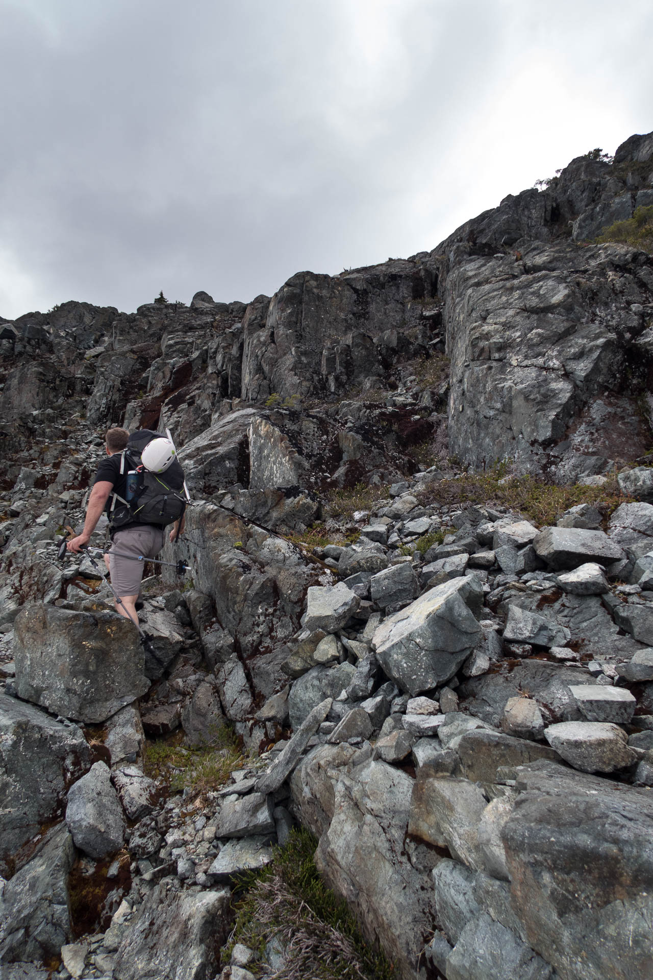
a few more short steps on the route to Puzzle Mountain
The next two and a half hours were spent walking some of the most aesthetic alpine terrain I’ve hiked on Vancouver Island. Mostly easy hiking, the few short steps were quickly scrambled by everyone in our group.

The view south from the summit of Puzzle Mountain. Volcanoe Lake below.
On the summit of Puzzle Mountain (1823m), we drooled over the sight of Volcano Lake and its surrounding ridge. Even more tantalizing was the view over to Volcano Peak. It looked like we might be able to descend off Puzzle and then right up Volcano, but our research didn’t yield any trip reports that described that approach, so we opted to do the long hike around the rim.

Descending to the ridge from Puzzle Mountain.
Departing the summit to the lower ridge requires some route-finding down a crumbly but obvious series of gullies. By 6:30 pm, we were well off the ridge and making our camp by a small tarn. Between the heather and the rocks, we found space for our three tents and moderate shelter from any winds. It was only a ten-hour day, but covering 11 kilometres and 1900 metres elevation gain in the hot sun made it feel much longer– we were knackered.
-

- Colonel Foster as viewed from Puzzle Mountain


-

- They call it Camel Ridge. I can’t figure out why.


-

- Up through the forest, things are getting dry.

Day 2
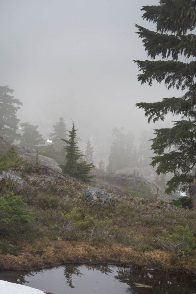
We woke to a disappointing surprise: thick cloud obscured our view, and the tents lay slack under the weight of the mists that accumulated on every surface. We could see little more than 150 metres. While we were ready for any navigation challenges, we worried about the miserable weather heading in our direction.
By the time we reached the southern end of the lake, the clouds had lifted high enough to offer some great views of Colonel Foster on the other side of the valley. As we trundled along the highpoints, we were forced to make a tough decision about Volcano Peak. Rather than deal with a questionable scrambling route on wet rock, and risk getting caught in the rain on our descent into Butterwort Creek, we decided to leave the mountain unclimbed.

Starting down to Butterwort Creek
At the third saddle from Volcano Peak (10 U 291358 5516965) we descended into Butterwort Creek. I think this is the route described by Stone in Exploring Strathcona, and it’s simple hiking in the sense that there are no dangerous bluffs, but it gets bushier the closer we got to the creek. By the time we reached the stream at the bottom, we were craving something easier, and made the crucial mistake of crossing it. We should have looked more carefully at the route description as it does give proper instruction. Heed it, and stay on the west side
On the east side of the creek, we zipped along quickly in the remarkably open terrain. Ultimately, we came to an unfriendly-looking section that forced us back down into the creek bed and left us exploring our options for gaining the very high walls back to the west side of the creek. We got lucky and found a muddy bank that gave us access back to the west side.
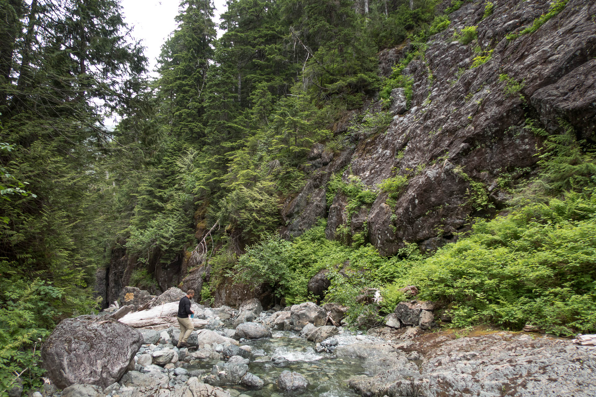
Butterwort Creek, stay on the left side
Back on the west side of Butterwort Creek, we pushed through the land of the little sticks for what felt like an endless afternoon. It’s a remarkable section of terrain that has little evidence of foot traffic, and just when I was wondering if it would ever end, we popped out onto the Elk River Trail at the bear cache and outhouse! Liberated from the bush, we took a quick break before pushing hard to get back to the parking lot.

A little bush before it gets thick
It was a fine pre-summer trip with only the minor flaw of a missed objective. We’ll be back, and likely, we’ll head back up Butterwort Creek to make that final objective on the ridge.
View the full album of images from the Wolf and Puzzle mountain trip
-
- Volcano Peak! So close


-

- less than ideal, this looks like an avalanche has stripped the rock of dirt and forest.

-
- into the mist!

Share this Post
Comments
Great information on an area I’ve been interested in. Thx.
It’s a great trip but it’s more than a hike!