Mount Flannigan is a 1550-metre peak located on the east edge of Strathcona Park. You’ll easily find it on the map because the park border sticks out like a sore thumb. The summit overlooks the Tools Creek Valley.
If you love backcountry skiing, then you’re probably already familiar with this peak because it’s mentioned in a few guidebooks written by Philip Stone. But if you’re not familiar with it, then it’s time to consider Mount Flannigan for a Winter/Spring trip. For a long time, Mount Flannigan has filled me with dread. The mere mention of the peak sent a shiver into the soul of my inner mountaineer. It’s not that the peak offers any technical challenge (it’s a walk-up); rather, it’s the approach.

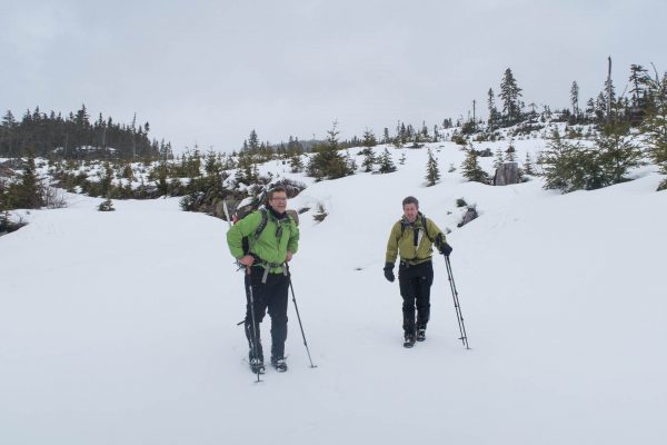
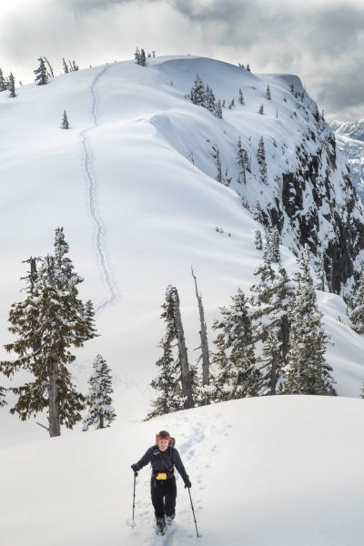
Still smiling!
Mount Flannigan sits on the north side of the Upper Campbell Lake, and this area is behind a BC Hydro gate. Phil and I have checked this gate several times and have always found it locked. In recent years, we’ve talked with only one other mountaineer who has hiked to it, via a long logging road approach. On his trip, he walked the length of the road from Highway 28 near the route up to Big Den–all seventeen and a half kilometers of it. In each direction. This is the source of my dread: a thirty-five-kilometer grind on a logging road isn’t my cup of tea.
But on March 26th, we got lucky; we found favour with the god of the gates and made a successful summit of Mount Flannigan. Earlier in the year, we had discovered that the gates were open for winter recreation; at that time, we felt that the peak was still too far from where we parked. This time, we came back ready to tackle the challenge.
Mount Flanningan Route
Horizontal Distance: 15.2 km
Starting Elevation 533 m
Maximum Elevation 1553 m
Total Elevation Gain 1172 m
Time: 7h 15 m
Even after finding the gates open, I held my breath as we drove the logging road. Several times I noticed snow piled up on either side of the road, obviously deposited by a snowplow. At any point, I feared, the plowing would end; the road would be covered in snow; and we would be forced to turn around. Instead, we got lucky again: the road was clear up and over the hump (~420m), and once we were on the southeast-facing side of the mountains, even the hills looked snow-free. There was only a moment of dread when we were discovered we couldn’t reach the place we’d parked on the first trip, parking instead at ~550 metres.

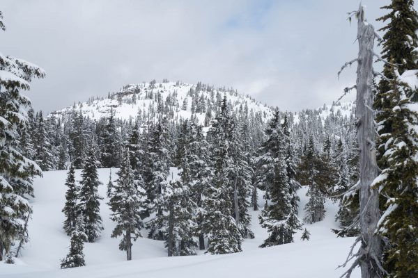
early morning, walking the last of the road . Our route crosses below the tree line.
The snow bore our full weight, so we set off with our snowshoes on our backpacks. As we walked, we stopped to examine two steep gullies that might provide a route up the east-facing slope to the plateau above (~1200m). We thought better of the plan: one was too steep and led to the wrong ridge, and on the other, we could hear water running below the snow. We opted, instead, to follow the road until we wrapped around a rock face, and took the first spur north to a steep, denuded slope.

into the gully!
The firm snow gave excellent purchase for our boots, and hid most of the treacherous slash below. We worked our way north to a ravine, then down into it. We each found our own preferred route out: Ramsay followed the gully up and out, while I opted to descend a few metres to a class two route up wet, mossy rocks to another patch of logging slash. And Phil picked the scramble route up the moss-covered rocks (of course he did).
Once we gathered, we continued east and eventually reached what we expected to be a plateau (~1200m). Either for the trees or snowdrifts, the terrain undulated and at no time looked flat. I hoped to see the lakes noted on the map, but they too were hidden under the snow. I was moderately disappointed, but the sun was shining and that spurred me forward, north to Mount Flannigan.
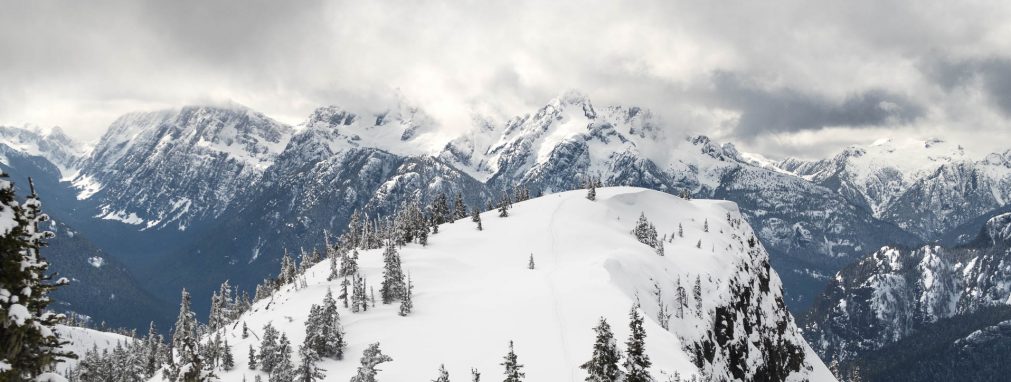
Eventually, our route intersected an unmapped section of logging road. We followed this for a short distance before heading off into the old-growth again, and eventually up to the summit ridge. Once we reached the saddle between the summit and the col, we were treated to amazing views.

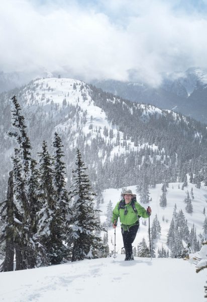
Phil climbing the final steps to Mount Flannigan’s summit.
As we followed the ridge, snow began to fall, but rather than a dark grey sky we were graced with long periods of sun that highlighted the snowflakes as they fell. The view of the distant peaks surrounding the Elk River valley was constantly changing, and made more interesting, by the cloud formations that engulfed them. It was a real treat to walk in the snow and the sun.
After reaching Mount Flannigan, we paused for a moment to check our data and review our maps. We had definitely reached the summit, but just 350 metres to the northwest, we could see the high point of the ridge. The trip across to the high point was well worth the extra effort. My best images of the day were captured here.

boot rack
As fun as our trip to the summit was, our return to the vehicles followed, mostly, the logging roads. It’s this route that allowed Ramsay to earn his Island Mountain Butt Sliders distinction –well done, Ramsay!
As for our snowshoes, they stayed on our backpacks for nearly the whole trip. Then, with only two kilometres remaining, we put them on. The snow had softened considerably, and we were breaking through the crust with every other step. There was some discussion about powering through just to say we did it without snowshoes, but I’m sure this would have added an extra half hour to the trip.
I’m happy to check this summit off my Island Alpine Quest. It’s a peak that I would happily visit again, but I won’t hold my breath. I don’t expect that BC Hydro will often unlock the gate.
-
- Looking tired! Note the snowshoes are still on our backpacks at this point

-

- Hey look there’s the summit over there… lower than this highpoint on the ridge.


-

- Easier than it looks


-
- a view of Mount Flannigan’s summit from the ridge.


-
- Phil climbing the last steps on the ridge to Mount Flannigan’s summit.

-
- Ramsay heading to the alternate summit!


-

- a careful adjustment of the glasses allows Phil the skill to walk the steep side slopes

-

- light snow, looking toward Crown Mountain

Share this Post