
 |
| Foggy days are common on the long moraine leading to Mount Albert-Edward |
One of my good hiking buddies recently joined the hiking club I belong to, The Island Mountain Ramblers. When he hosted his first trip, I was surprised to find out that I was the only person to join in for the long day hike to the summit of Mount Regan. Together, he and I are working on the list of peaks in Philip Stone’s Island Alpine and Vancouver Island’s 6000 footers.
 |
| GPS Route with photographs |
Total Distance: 36 kilometres
Starting Elevation: 1070 m
Maximum Elevation: 1951 m
Total Elevation Gain: 2028 m
Total Time: 10 h 45 m
In anticipation of a day that would see us log more than 32 kilometers with a significant amount of elevation gain, we we hit the trailhead early. We were off and moving by 7:30 am. We motored through the banal sections of the hike, both to keep warm in the drizzling rain and because Paradise Meadows has lost its charm; I have affectionately started referring to it as Paradise Lost Meadows.
 |
| A view of Lake Helen Mackenzie |
The trailhead (1050) to Circlet Lake (1180 m) is the first section of the hike. It is approximately 10 kilometres of easy hiking. Though the elevation difference between the two locations is not significant, there are a few ups and downs along the way, about 400 meters of elevation gain/loss can be expected. For the most part it is well marked and the trail is maintained in excellent condition. It heads south from the trailhead to Lake Helen Mackenzie. We followed the trail along the west edge of the lake the col between Mount Allen Brooks and Mount Elma, this is the worst section of the main trail. Because it lacks boardwalk, hikers seek their own routes through what has the potential to be a mire of mud and roots. Now, the trail is significantly eroded, it is in need of restoration.
From the saddle, the biggest challenge is finding the correct trail to take, many different routes intersect but there are markers along the way. Moving quickly to keep warm in the cool wet conditions, we made it to the lake in under two hours; much faster than usual. On the way we passed a large group of international backpackers, heading out in full rain gear. They were in good spirits, probably because they were hiking out. They looked at us in our shorts and rain jackets as though we were a bit crazy, and possibly they felt as though we were heading in the wrong direction.
 |
| One of the many dry tarns from this summer, cracked from the heat |
Circlet Lake is the end of the trail, from the lake follow a booted route westward. The route gains the long moraine ridge (1650 m), leading up to the junction between Albert-Edward and Jutland. It’s mostly easy to follow, though the terrain becomes more challenging than the simple approach to Circlet Lake. The first obstacle rears itself quickly after the lake, ascending a steep slope that is slippery mud or slippery dirt, depending on the conditions when you hike. Either way you split it, you may have to use your hands to get up the slope. If you make it past this slope, rest assured that you have overcome the most challenging section of the hike, other than navigation of course.
Phil and I didn’t follow the main route to Albert-Edward, we stayed low. We walked a booted route, lower than most take and we didn’t reach the Jutland/Albert-Edward route cairn. As we mounted the ridge we made the decision to abandon our plan of hiking Mount Regan, there was simply too much fog and rain. With our visibility at less than 50 metres, we checked our maps and GPS and made the choice to follow the route south, leading toward Mount Frink.
 |
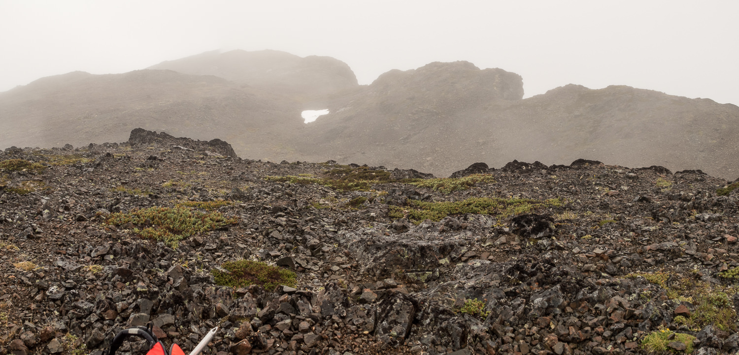
| The long moraine leading to Albert-Edward, bring navigation material!! |
Heading to Mount Frink, we depart from the rocky moraine leading to Mount Albert-Edward, losing elevation to cross to the slabby rock saddle (~1800 m) between the two peaks. At the saddle between the two peaks we had a moments viability, enough to pick a route.The slab is short lived and before long we were meandering through the choss and boulder slope heading up to the multiple bumps that emerge from the broad Mount Frink Plateau. To gain the plateau we stayed on the northwest face, making our way to the skyline on the hikers left, we easily avoided the minimal amount of rocky bluffs. It’s slow going but the route finding is easy as we made our way to the summit…we think. In the mist and fog it’s difficult to know if we had the main peak.
We didn’t spend long on the summit. It was cold, wet and the wind was blowing. We found a geocache but it was too wet to sign. We stacked up the cairn and carried on to the second destination, Castlecrag Mountain.
The route finding from Frink to Castlecrag is the most challenging of the entire loop, at times the booted trail becomes faint and there are a number of off shoots that could lead a mountaineer astray. From west end of the Frink plateau, (1937 m) descend down heather covered slopes. On a good day you may see Moat Lake on your left, fog kept us company. Basically, we follow the broad ridge down a steep section to to col between Frink and Castlecrag at (1670 m). As a note, there is one point where you may be tempted to descend lower than you need too, a booted route leads you too low, look on your left toward a treed area, there is a gentler route through there that gives access to the col.
 |
| The impressive looking stack of rocks makes for a great sub-peak on Castlecrag Mountain |
As you hike you will see Castlcrag loomining ahead of you, the trail cuts right around the summit to a much easier path up the south face. The route to the summit is simple hiking with a small section of class three (maybe). On the summit (1758 m) we took a moment to enjoy ourselves, pulling out our snacks we took advantage of a brief break in the weather to relax without the pummeling of the rain. With both of peaks done for the day we started out toward Circlet Lake, completing the loop before heading back to the trailhead.

From the summit of Castlecrag, Circlet Lake is 6 kilometres away and loses more than 700 metres of elevation. Perhaps it was the length of the day or maybe it was the simply the terrain but I found this section to be the most physically taxing. The route twists and turns around numerous features, bluffs, tarns and trees and several massive boulder fields. These boulder fields require careful foot placement and in some cases will require you to use your hands. They are not loose scree but the giant blocks do shift under your weight so be careful with foot placement. Keep your head up and look for indications of where your route goes before taking your next steps.

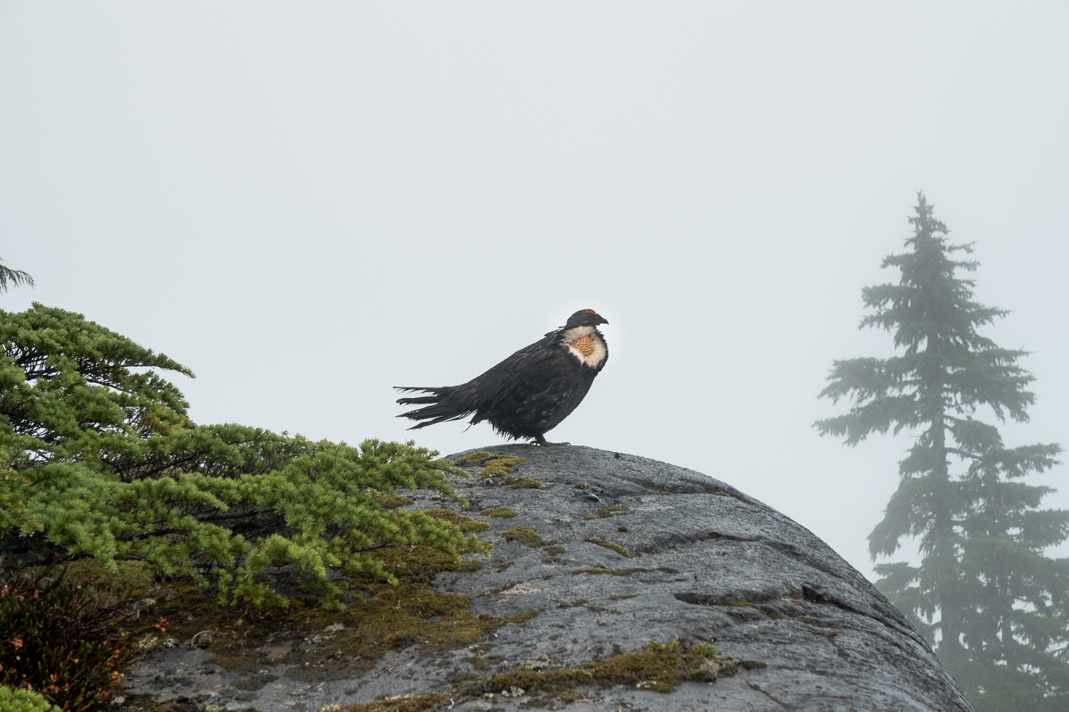 |
| On our way back to Circlet Lake we nearly ran over several grouse and spotted a male grouse as he was whooping it up! |
We arrived at Circlet Lake around 4 o’clock. I had a brief moment of euphoria, the kind of feeling you get when you finish a hike… it faded quickly as the reality of our situation set in… 10 more kilometers to the trailhead….
 |
| By the end of the day, water was refilling the dried tarns |
As we marched through Paradise Meadows we were all but silent, both of us tired from the effort of the day. Our only remarks were regarding how wonderful the late afternoon had become. The rain abated and we opened our jackets to stop ourselves from overheating. We arrived at the car around 6:15. We were pleased with our time.
If you are planning this hike, know that we were very focused in our hiking, spending little to no time taking photographs or taking time to smell the flowers. As noted we did our hike this way because of weather and the fact that we have both done large sections of this hike multiple times. I would suggest it’s impossible to do this hike this quickly, if it is your first go at the region.