
Our late September trip to Pinder Peak was fantastic! The combination of a dry, cool day on a snow-free route filled with plenty of alpine berries reminded me why I (sometimes) love fall hiking! This trip was very different from my first trip to Pinder Peak.

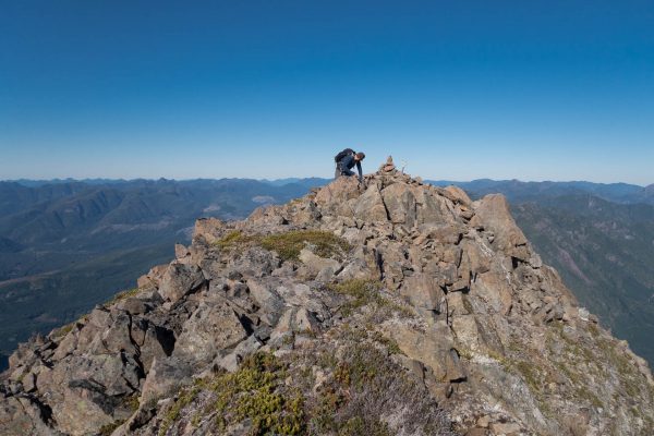
summit cairn
If you’ve ever driven along by Atluk Lake, you’ve probably spotted the Pinder massif out your window. It rises from the wooded shores of the lake as a rocky tower that begs the mountaineer to climb it. The summit massif is marked by two prominent features, either of which is a worthy objective, though the subpeak is probably more of a challenge.

Total Distance: 14.0 km
Starting Elevation: 360 m
Maximum Elevation: 1550 m
Total Elevation Gain: 1223 m
Total Time: 7 hours
https://drive.google.com/open?id=1Y3HJoYH1gDWR7gR4ygfgLU2Jq5XFxxIW&usp=sharing
For the most part, we followed the route provided by Martin on Summit Post. The lower portion of our path was filled with wind blowdowns and terrain difficulties that, at times, forced us to wade through unyielding thickets of stunted evergreens. But I don’t want to focus on the worst parts of the trip, because there is plenty of lovely mature forest and open hiking, after a five-kilometre logging road approach.
Part of our trip plan includes generating an estimated timeline for hiking, which helps determine a turnaround time. We use the conventional formula of one hour for every three kilometres of hiking, and one hour for every 300 meters of elevation gain. We know we can move much faster than this, but it does allow time for route-finding and unexpected terrain troubles. Usually, what we gain in one place we can lose in another if we have to fight bush. For our trip on Pinder Peak, we allotted up to two hours each direction; so you can imagine our glee when we reached the end of the road (760m) in under an hour, and we hadn’t even broken a sweat –I love chilly, dry fall mornings!

Beyond most of the lower shrub hugging, we caught a view of the mountain.
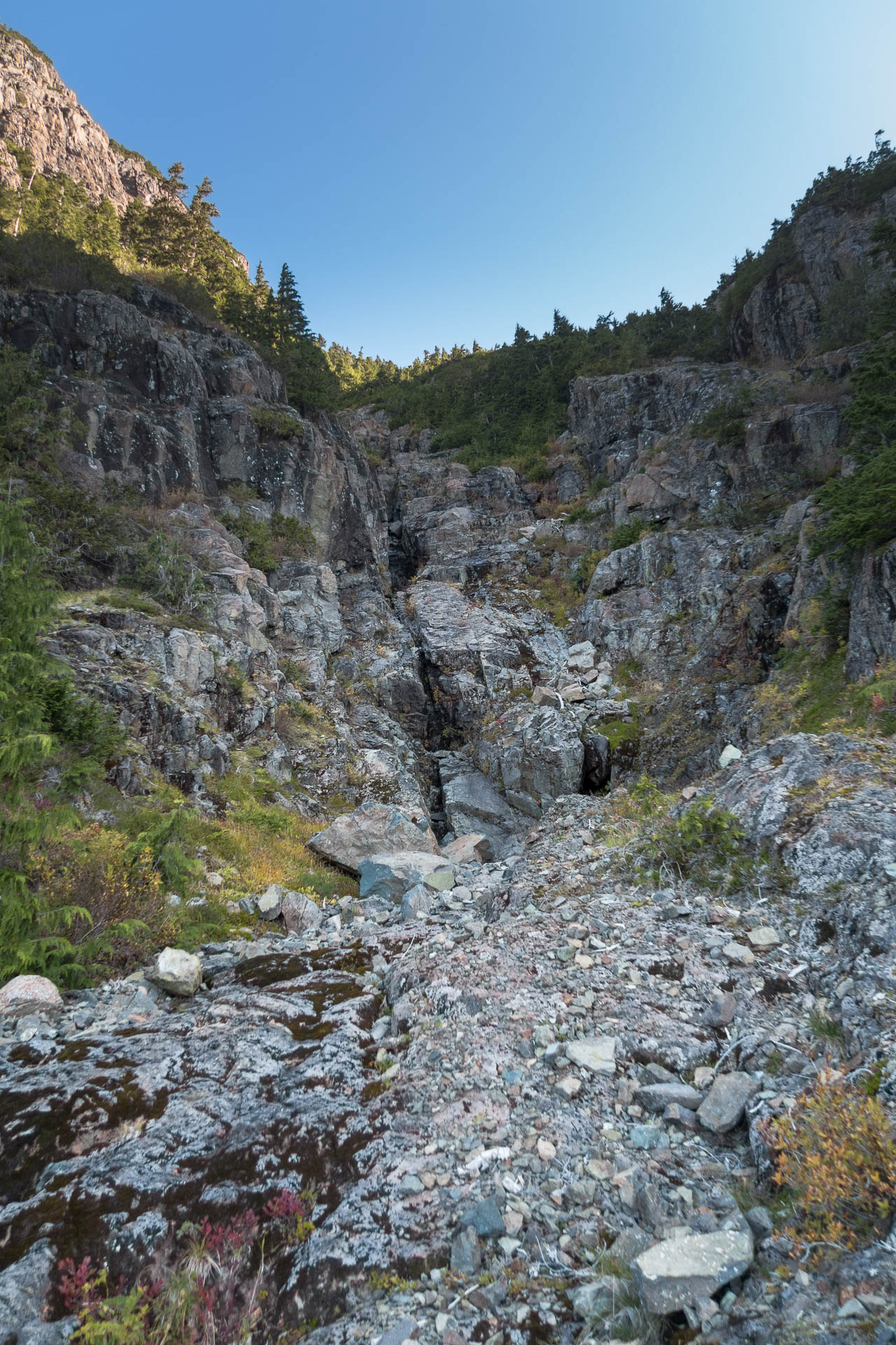
From the road’s terminus, we piled into the cut-block and headed down through the dry watercourse to the left side. Paralleling the dry feature, we headed up and over a mess of blowdowns through waist-high blueberry and azalea that easily parted, until we found ourselves subsumed below the old-growth canopy. As we climbed, the bushes thinned, and eventually we crossed the first watercourse (~ 1025m) and traversed over to the second watercourse (~1090m).
up the middle and at the next level turn hard right; we came back on the right.
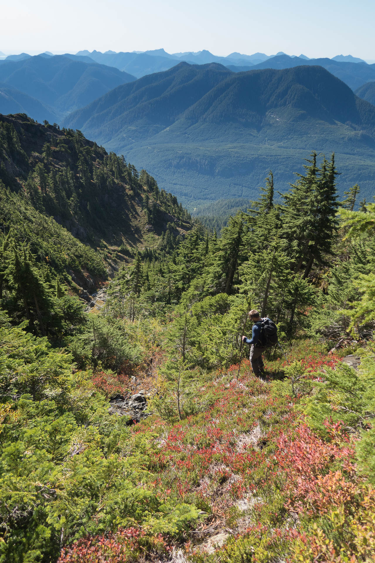
The air was still crisp, but the sun had cleared Pinder’s subpeak and was starting to beat down on us. From here, we deviated from Martin’s route, which traverses farther east through the bush; instead, we stuck close to the gully. Eventually, this forced us into some heinous bush, the kind that you have to fight to push forward. But be careful — sometimes, it fights back! More than once, Phil slingshotted back towards me as I stood by, waiting for him to clear the obstacles. Eventually, we took to our hands and knees to crawl under the bush and back into a lovely open area on our way toward the saddle (~1350m). From here, the route turns sharply left up a heather-covered ramp that leads to the south ridge (this feature isn’t visible until you’re upon it).
Descending the ramp
Once we gained the ridge, we were starting to sweat. The sun beat directly onto us, but we didn’t want to slow down. We were close to the summit, and it inspired us to push forward through another small patch of brush, routing around a rock feature and then a walk up to the summit.
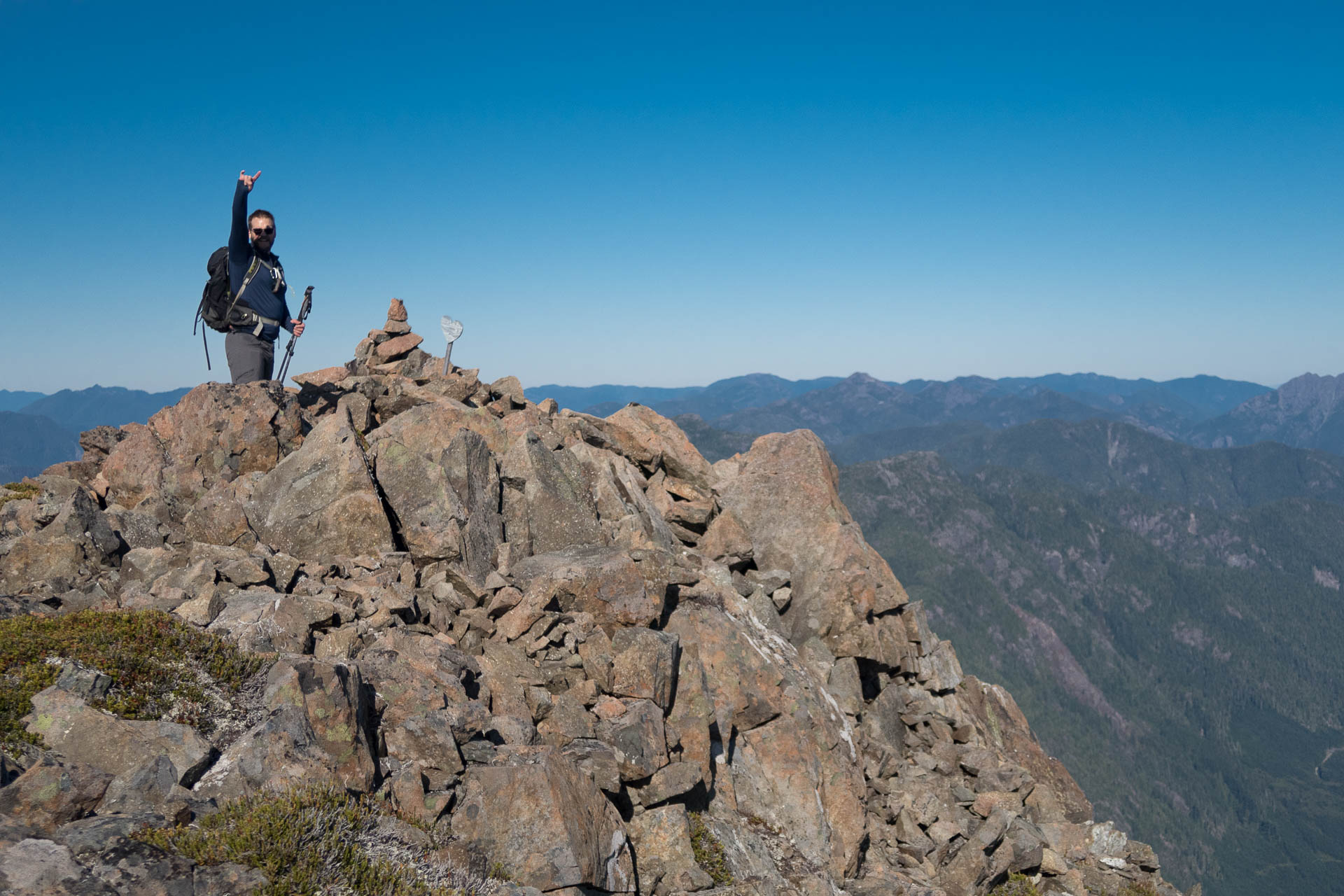
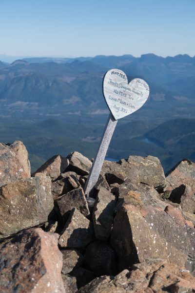
On the summit of Pinder Peak
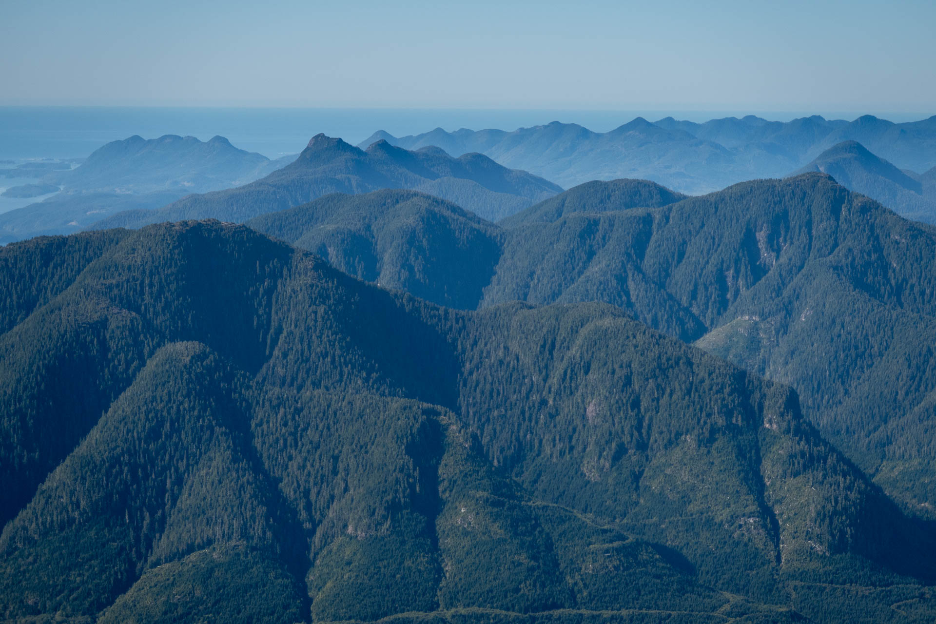
We arrived on the summit of Pinder Peak before 11:30 am, ahead of our schedule. We rewarded ourselves with an extended snack break on the windy summit. We couldn’t help but gawk at the surrounding features. The clear skies gave an excellent panoramic view, including out Tasish Inlet to Kyuquot Sound.
Bumpity-Bump
When we finally left the summit, we vowed to stick closer to Martin’s route for the descent. It was a smart decision that allowed for much simpler walking, as it bypasses the worst of the bush that we fought on the way up.
Hopping back into the gully at ~1090 metres, we noted a very old flag, one we missed when we were choosing which route to use. We shrugged and started back the way we came but got sucked into a flagged route that brought us to a dry watercourse, which here was more like a lovely gravel path. We followed that for a while, but when I spotted a well-used ramp leading out and up to the hill on the left, I took it in hopes of avoiding the blowdown we found at the start of the route.

Up and out of the bush.
The plan worked out in one regard: we avoided the blowdown. The trade-off was the bash through regrowing saplings. Fortunately, they were bone dry, and other than the odd scratch, we pushed through back to the road without incident.
It’s great to achieve success after my previous failed attempt. But it was even better to get back to Nanaimo in time to put the kids to bed. I know some would complain about a 7-hour hike with an eight-hour drive, but for me, it’s the right balance of family and adventure.
Those peaks on the horizon are slowly becoming bumps we’ve already visited.
Full album of images
-

- Up and out of the bush.

-

- Pinder Peak on the left.
-

- Though we went up the gully, the less bushy route would be to cut hard right into a short bushy section and easier hiking.


-
- The ashes are still dry
-
- summit cairn
-

- a bit more bush
Share this Post