
If I take a moment to assess the remaining objectives on my Island Alpine Quest, I have no doubt that many of them will be challenging. Some require grueling multi-day bushwhacks, canoe/kayak approaches, or fly-ins, and some of them will require roped-up climbing. Patlicant Mountain, however, requires none of these things.

I enjoyed seeing these few trees standing tall in the mists until I realized it was only thanks to the devastation that I was afforded the view
Patlicant Mountain is in a class of its own, one of the few peaks in Island Alpine (Stone, 2002) that make me wonder, Why is it included in the book? Perhaps in 2002, it was an objective worthy of the hike, but now there’s not much adventure to be had.
Earlier in the week when we didn’t have a trip planned, I joked that we could set Patlicant Mountain as the objective; but in fact, the plan for the day was to summit Hannah Mountain, on the opposite side of the Alberni Inlet.
December 10th was one of those days where we questioned our sanity: water poured from the sky and at times the windshield wipers on my Jeep struggled to clear the water. Still, we were determined to get this easy objective, but after several hours of driving, we discovered that the road Phil had used on a previous trip was overgrown.
We considered walking the road but realized that the extra elevation and distance could add up to three extra hours of walking. That extra time would mean a walk through the bush at night–we don’t like that type of planning.
We noted a possible alternate driving option, but it too revealed a deactivated spur. Our decision to choose a new destination was also influenced by a growing suspicion that the road may be reactivated soon: we spotted flagging leading down the road.
Never ones to waste an opportunity, we used the time to explore the Nahmint River Valley and the back route to Mount Klitsa. As we drove deeper into the Nahmint Valley, it started to snow; by the time we were close to the start of what will be a future adventure to Nahmint Mountain, there were several inches of snow accumulated on the ground at just 300 metres!

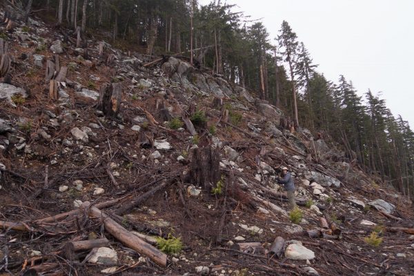
Phil at the start of the hike–looking fresh!
Having explored the route to these future hikes, we retreated back to Port Alberni, and down the Bamfield Road to Museum Main. With a not-insignificant amount of road exploration, we eventually found our way to the end of the road (or at least a road) at about 1100 metres.
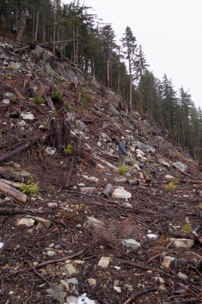
Here on the south-facing slope of the west ridge, we started our mega-adventure to the indistinct summit of Patlicant Mountain. Regardless of how undemanding the trip is, we still discovered some easy rock scrambling, wedging between tightly packed immature forest, slippery logging slash, and snow above 1200 metres (bizarre, right? Especially considering there was snow down to 300 metres in the Nahmint Valley!). Despite this short trip, we weren’t deprived of some of the common ailments of our longer trips: wet boots, snow up the pant leg and into the boots, and a few slips.

ON the summit–looking fresh!
On the summit, we caught only peekaboo views of the valley through the cloud. We weren’t all that disappointed, as the time investment had been negligible. It was a greater disappointment to find a road within 100 feet of the summit; I had missed an opportunity to park my Jeep on the summit of one of the Island Alpine Quest peaks.
By day’s end we were fatigued, albeit mostly from the drive. Back at the vehicles, we checked our data: we had covered less than 100 meters elevation gain, less than a kilometre distance, and been on the move for less than 25 minutes.
Was it worth the drive (because of our exploration, more than six hours)? The answer to that question has a lot more to do with our overall goal than this individual peak. I’ll ruminate on that question a few years longer.
Share this Post