Canoe Peak is a thorn in my side! It’s approaching comical how many times I’ve set this peak as our objective for a trip and then had to change the plan. Be it weather forecast, avalanche conditions, a blizzard through Sutton Pass, or zero visibility, for one reason or another I’ve made it only as far as the upper ridge. It was early in the morning on March 18th that six of us joked as we started hiking: Sixth time’s the charm?
Total Distance: 12.2 km
Starting Elevation: 62 m
Maximum Elevation: 1200 m
Total Elevation Gain: 1167 m
Total Time: 7 h 15 m
A poor forecast wasn’t enough to turn us back: we were determined to have a great day in the mountains. We parked at the gates (~100m) on the service road that leads to the micro-dam project operating in the Canoe Creek. The route follows the road to its end, and from there it’s all off-route to the upper ridge. We found an old trip report that described the route, and used this to plan our trip.
As we walked the steep road, I noted that the author of the previous report was correct: the walk is lovely! Where most logging roads traverse apocalyptic logging slash, this road zigzags southwest up the Canoe Creek valley, along the slopes, while tall mature trees line the roads.

creek crossing
The road allowed for a quick pace, and very quickly we found our first snow (~500m). Since we’re a stubborn lot, we left our snowshoes on our backpacks and instead suffered through snow that was, at times, close to knee-deep. Once we passed the micro-dam and crossed the creek, we were into the old-growth.
Beyond the creek, we set our course for the upper ridge. We negotiated around natural features and through the leafless stalks of low-lying shrubs. The worst of the terrain required scrambling down and up slippery, moss-filled gullies. As we approached the edge (~800 m) of the treeline, the consolidated snow lost its compact character of the lower elevation, and we were forced to stop and put on our snowshoes.

As we did, I noticed blue patches in the cloud and the odd beam of light casting down into the forest. By the time we were hiking in the alpine (above 1000m), the sun was beating down so hard that many of us put on eye protection. The bright sun fought against the cool breeze, and many of us hiked in merely our shirts, stuffing our jackets into our bags.
As we walked in the open alpine, a thin crust broke away below our snowshoes, revealing a thick layer of ice pellets –grauple-like– below. The marble-like conditions slowed our progress and created slippery conditions for those that followed behind the leader – perfect conditions for an avalanche, had the slopes been any steeper. Our attempts to move directly forward were met with the old ‘one step forward and two steps back,’ so we cut long, low-angle switchbacks.

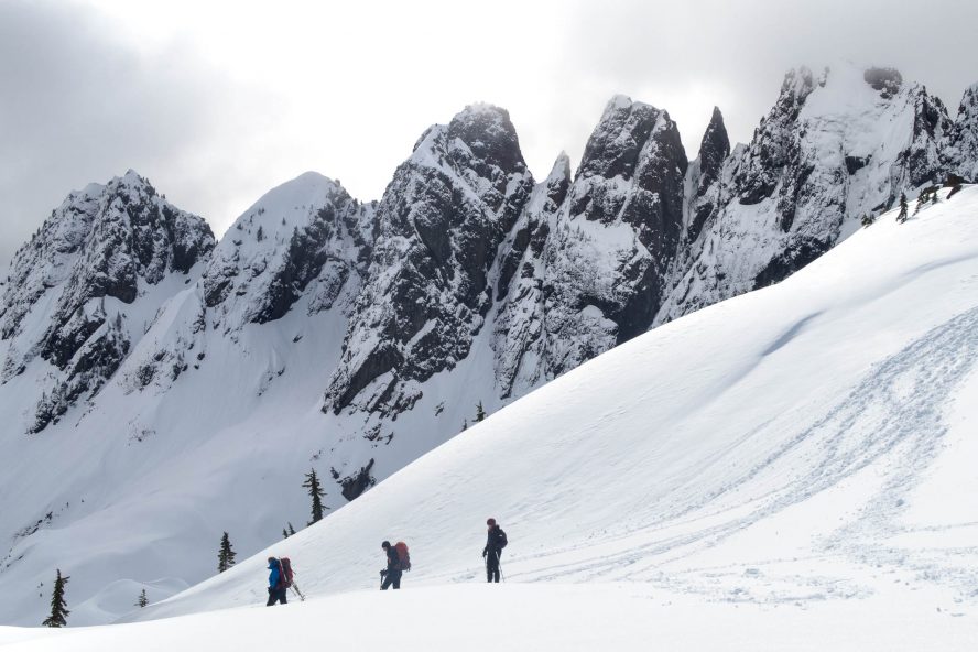
Shannon and Phil stand in awe looking at the Mackenzie Range
Upon reaching the top of the ridge, we stood and admired the panoramic view. To the west, across the highway and the Kennedy River Valley, we could see Maitland Range, Maitland, Hidden, and Steamboat Mountains. To the south, the Kennedy River snaked along the valley floor into Kennedy Lake, which stretched out until the mist stopped us from seeing any farther. The eastward view was just as rewarding: Canoe, Cats Ears, Redwall, and many of the features that give a dramatic, big-mountain feel to the Mackenzie Range. It was breathtaking.
From our high point on the ridge, we examined the route stretching out below. It would be a lot of elevation loss to traverse below the long pointy ridge and Redwall before heading up another slope to the saddle between Canoe Peak and the ridge. Worse, the length of the route would require us to walk below steep, snow-loaded slopes, and if that wasn’t enough, the final slope up to the saddle was an obvious terrain trap. Snow mounds dotted the ridge high above, and now sunlight was falling on them, highlighted against the shadow of the ridge. It’s as though nature was emphasizing the danger for us, trying to tell us something.

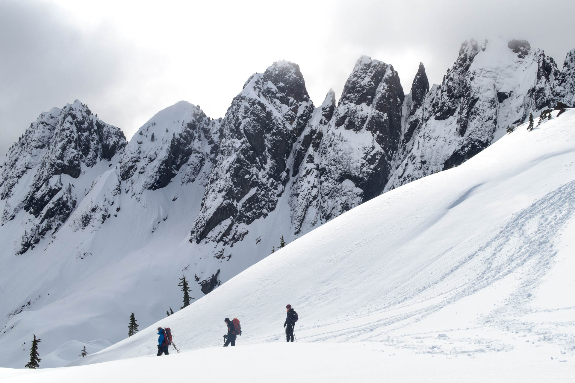
A view of the Mackenzie Range, weather rolls in.
We listened. This was the end of our Canoe Peak trip, though we did take the time to explore the short section of ridge we were on. The sun and the views suppressed any feelings of discontent. As we admired the views, cloud started rolling in and a cold wind kicked up. It was time to beat a hasty retreat.

Just a little butt-sliding to make the day complete.
What took us four hours to ascend took us only two and a half hours to descend. The road back to the cars was a real knee-cruncher. I hadn’t noticed how steep the road was on the way up, but on the way down, I took my time to find footing on the loose gravel.
As for the weather, within a minute of starting our drive, the rain started to pelt down –we got lucky!
We’ll have to put this peak back on the schedule again. Perhaps next time we’ll try another route up the valley, or just use the old climber’s trail that travels below Mackenzie Peak and camp overnight. Whatever the case, we had a fabulous day in the mountains, arriving home alive and ready to take on the next adventure.
-

- heading home
-

- Israel and Shannon catching the view

-

- A true sense of scale. We are just ants!


-

- Shannon and Phil stand in awe looking at the Mackenzie Range
-

- The Kennedy River and Kennedy Lake


-

- The weather gives endless change views of the Mackenzie Range


-

- ANTS!


Share this Post