Phil and I have come to the consensus that, although we have accomplished a lot on our Island Alpine Quest, we have merely begun to scratch the surface. In the past two years, we’ve partnered on more than 60 summits, but the truth is that most of these peaks are the easiest objectives from the list –easy to get to, and easy to summit. The further we get on our quest, the more challenging it’s becoming to find the next peak we can achieve as a day trip – especially in the winter! Other issues come with seasonal access through gates, and the elevation of the snowline; both create long logging road approaches that eliminate most objectives on short winter days. It’s on these days that we look for short trips that let us reach an objective. On December 23rd, these factors led us to Adder Mountain.

Adder Mountain Route and Map
Total Distance: 12 km
Starting Elevation: 624 m
Maximum Elevation: 1520 m
Elevation Gain: 1090 m
Time: 6h 15 m
https://drive.google.com/open?id=1LZ5OU4K3VFCpNy3KN5hDIbvTq8I6Z5MW&usp=sharing
Adder Mountain is a destination that’s been on my radar for quite some time, but it’s always been one to save for a rainy day. Phil and Rick did this trip together back in 2013, so it wasn’t a high priority for Phil. But when I suggested it as an option for a short trip on a date close to Christmas, I was able to twist his rubber arm and he agreed to the trip.
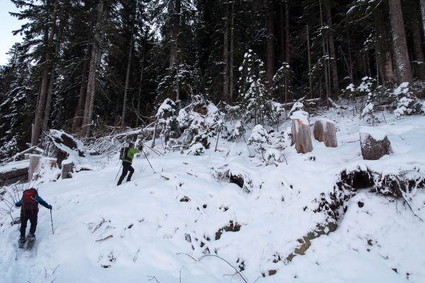
Our group of five rendezvoused at the Whisky Creek Co-op before heading out to our destination in the Mackenzie Range. After months of adventuring in the north island, the two-hour drive from home felt quick! Just beyond Sutton Pass, we turned left onto the logging road and drove toward the trailhead at the end. We were forced to park around 650 metres; though the road continues on for another kilometre, we were unable to drive the final steep hill. A combination of loose rock and skiff of snow caused us a degree of trouble that saw my Jeep sliding backwards downhill, drifting toward the side of the road into nowhere. I was only righted by trying to pull forward, allowing my tires to spin while Phil pushed the back end of my Jeep back in line with the hill. Yup, we didn’t drive any farther.

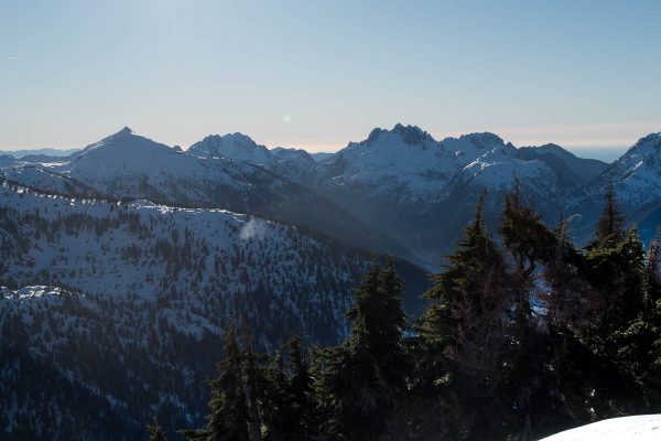
sunrise showing in the mountains
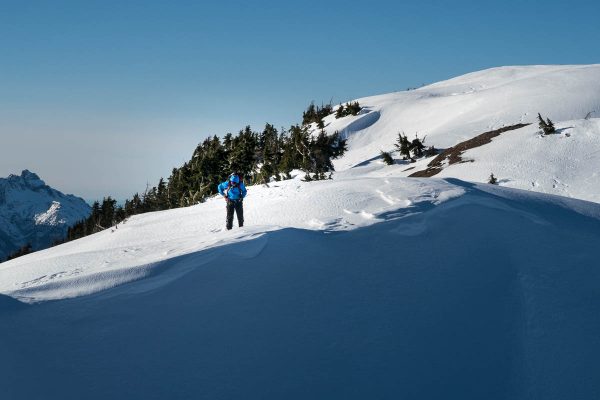
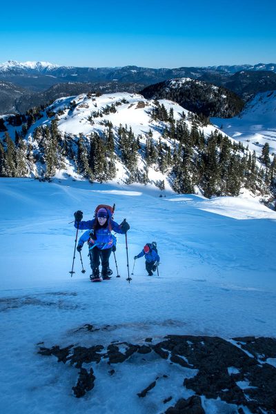
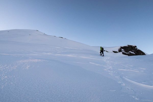
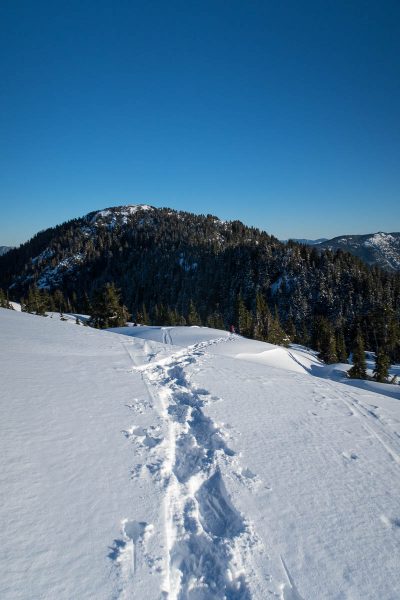
The forecasted low was -2, but in the predawn light the dry air felt much colder. The snow was only two inches deep, but rather than slipping on the snow, we let the snowshoes do the work for us. It wasn’t long before we passed the end of the road (~800m), and hiked up along an established trail marked by a sign reading “MT ADDER”. Even though the snow was several days old, it still retained the fresh character of champagne powder. We followed the established route marked clearly by a skin track, down into a valley and then south, gaining elevation up to a saddle high up on the ridge (~1100m). The route turned to our right, and we continued southwest through a snow-covered landscape, hills rising high on either side as we moved toward Adder Mountain.

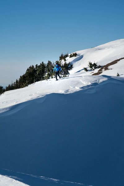
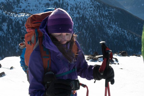
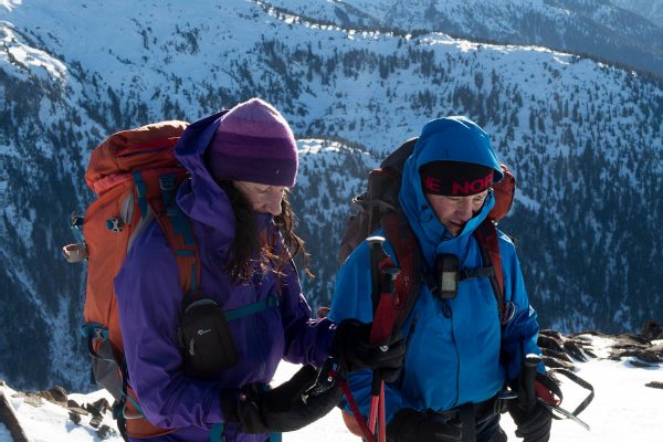
Colleen warming herself in the morning sun on our hike up to the ridge
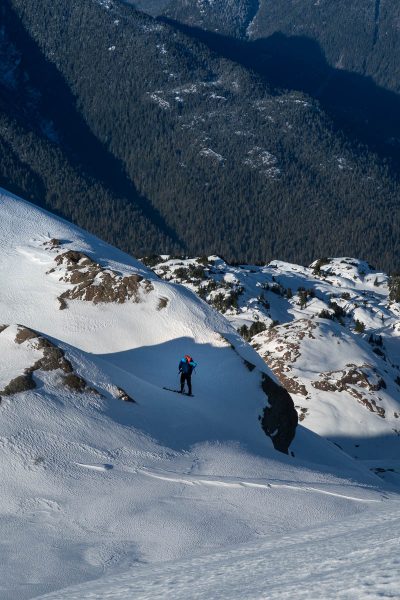
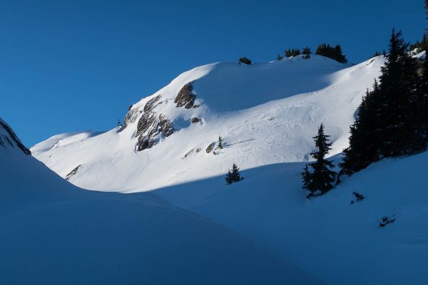
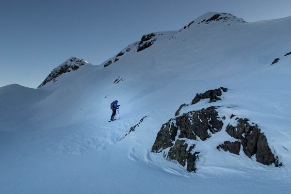
It’s difficult to say what the route would look like in the summer, but when we reached 49.2528, -125.3218 we found a short steep descent into a notch. This short descent foreshadowed more to come. The snow presented only a minor problem: the champagne powder was only six inches deep here, and sat on top an icy crust that bore our weight. It didn’t take much to get down. But we did grasp nearby trees to control our descent, and stop us from plunging into the terrain below.

looking from whence we came
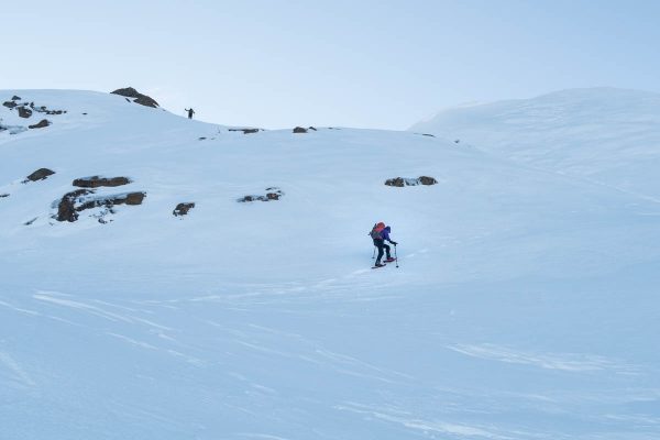
Ascending out of the notch, I removed my snowshoes to kick into the crust to the step above. As we continued gaining elevation, we were exposed to the harsh, freezing wind. Though the sun blasted the hills behind us, we were hiking in the shadow of Adder Mountain. With the cold air temperatures, each of us was forced to wear multiple layers, including windbreakers with hoods pulled up tight to protect our faces, and many of us wore eye protection.

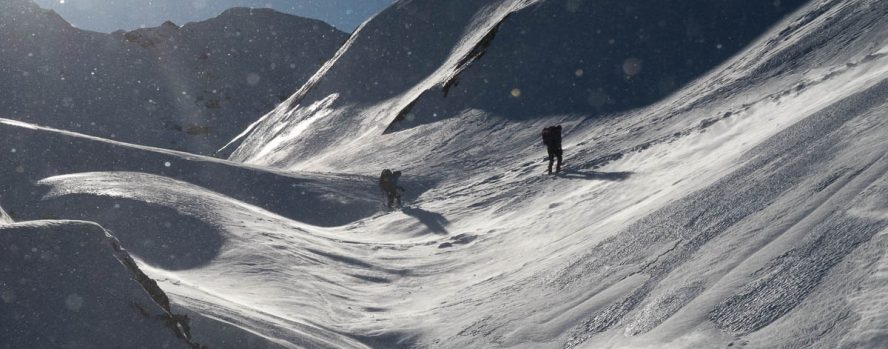
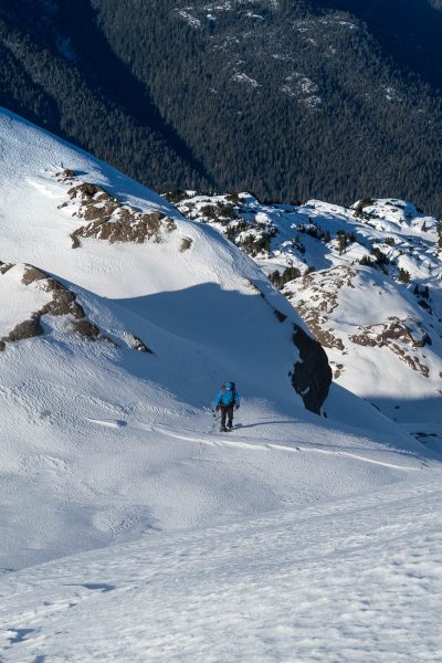
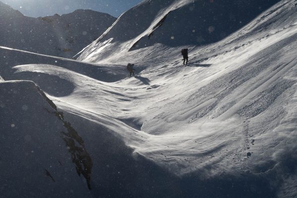
hiking up in the shadow of Adder Mountain
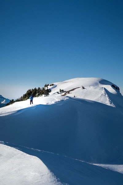
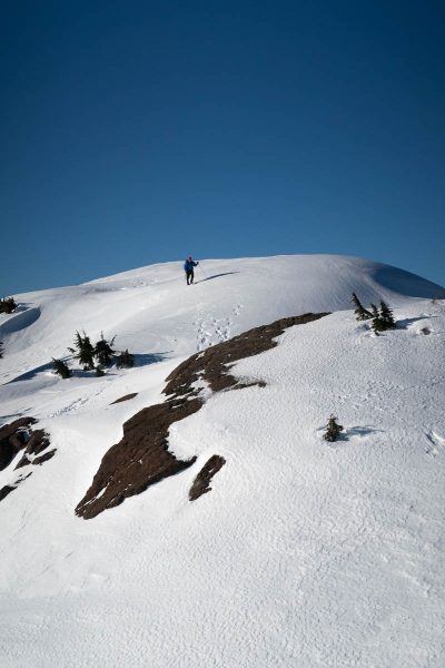
The winds must be a common issue here, because the terrain was very different from that below. There was no more powder; instead, we hiked on firm snow, and in some places, ice accepted the crampon of our snowshoes. Overall, the terrain was rolling, but I couldn’t help wondering what lay below the snow and ice.
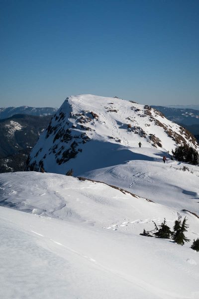
Phil was leading us, and way out in front, he picked a route up a steep rib on the west end of the summit ridge. Up we went, our snowshoes leaving nothing but crampon marks in the crust (I’ll note that Rick and Bob went up the obvious main gully and, somehow, surmounted the cornice that had formed on the ridge).
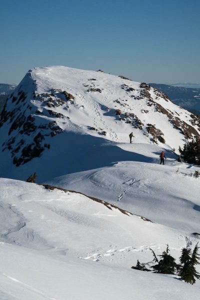
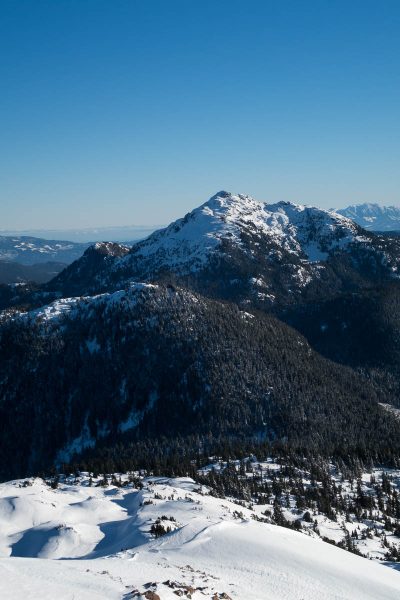
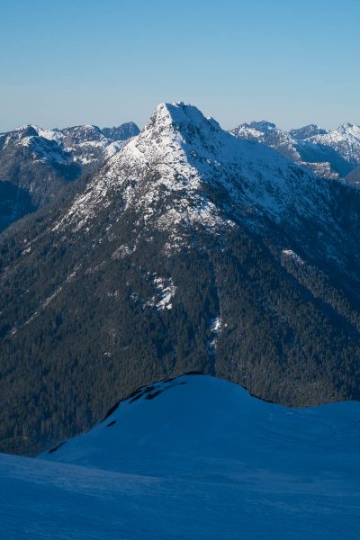
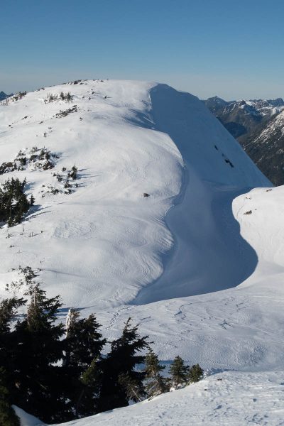
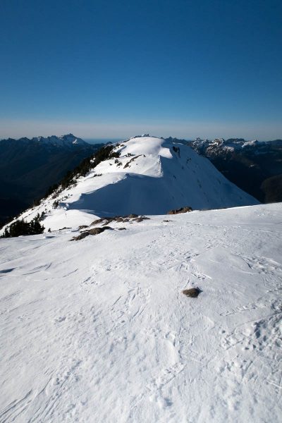
Once on the summit ridge, and no longer in the shadow of the colossus, the sun illuminated the aesthetic alpine ridge to the summit. Eventually, we each had our moment in the sun, and on the summit. The 360-degree view offered some amazing views of the neighbouring peaks: Mackenzie, Redwall, Cat’s Ears, and Triple Peak to name a few. But the bigger surprise was the amazing view of Nine Peaks and Rosseau Ridge!
-
- catching up!

-
- Id’ rather be butt-sliding

-
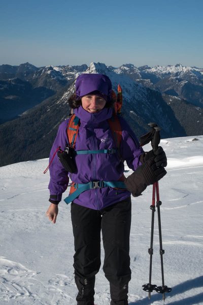
- Smiles all around

-
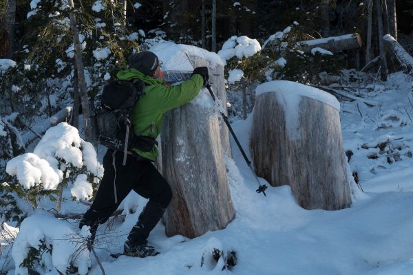
- Rick adjusting gear getting ready for the walk down

Descending, we followed the same route, including the steep ice-covered slopes to the lower levels. Although Phil simply walked down, I lacked the guts to do it facing forward, and instead chose to use the pick of my axe to help me feel in control. The others changed into crampons to descend to the gully below.
Once off the summit massif, we made quick progress, and ultimately we all made it back to the Jeep by 2:00 pm.
In the big picture, this peak was a good option for the conditions; however, if the snow level dropped lower, the long logging road approach would make the route undoable as a day trip. That being said, if you’re keen on skinning up, this route may be worth exploring.
-
- a short but sweet alpine ridge on the way to Adder Mountain
-
- Rick ambling along the fine summit ridge on Mounta Adder
-
- Rick strutting his stuff.
-

- Colleen warming herself in the morning sun on our hike up to the ridge
-
- zipped up to protect our faces from the wind
-
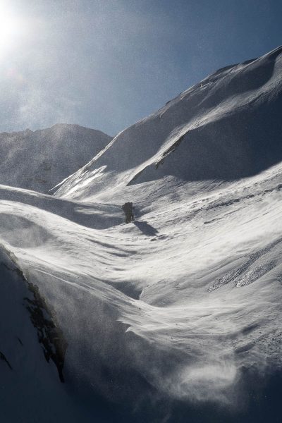
- snow blowing in the wind
-
- the final few metres to the summit on Moun Adder
-
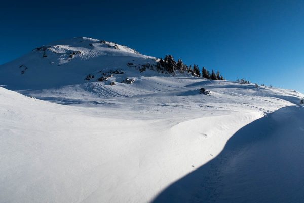
- wind-sculpted ridgeline highlights the dramatic lighting on this bluebird day.
-
- uncovering the sign that points to Adder Mountain.
-
- just one more hill!
-
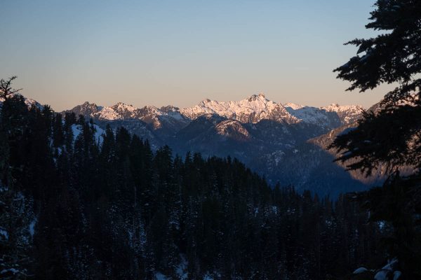
- sunrise on the distant mountains: Big Interior, 9 Peaks
-
- Rick adjusting gear getting ready for the walk down
-
- hiking up in the shadow of Adder Mountain
-

- looking from whence we came
-
- Where are we?
-
- Mount Gibson and Mount Klitsa
-
- on our way to Adder Mountain between two humps
-
- Rick after chopping through a small cornice, standing on the summit ridge of dder Mountain
-
- Pogo Peak
-
- Colleen warming herself in the sun on our hike up to the ridge on Adder Mountain
-
- Phil, running up the slope to get out of the wind
-
- driving winds blowing snow up off the ground and into our faces,
-
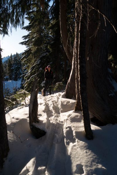
- stepping off the road and onto the trail to Adder Mountain
-
- Id’ rather be butt-sliding
-
- the shadows begin to creep across the landscape pm Adder Mountain
-
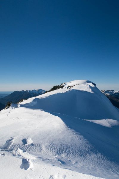
- Adder Mountain’s summit ridge
-
- Collen wending her way up the slopes, Phil, waaaaay off in the front
-
- the snowshoe track, Mount Gibson in the background
-
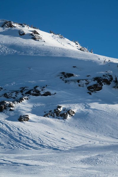
- Adder Mountain looks more impressive than it really is
-
- If you want to hike to mountain tops, you need to walk up a few hills!
-
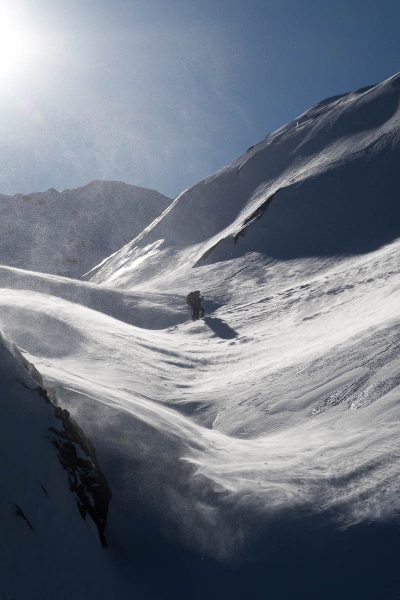
- snow blowing in the wind