
The day’s goal was Canoe Peak, but a series of pre-existing minor injuries and unfavourable route conditions in the Mackenzie Range conspired to stop us from reaching it. Despite our misfortune, we still enjoyed the day.
The Mackenzie Range features some of Vancouver Island’s most dramatic-looking peaks, the type that inspires Island Mountaineers to chase after them. Among them you can find Triple Peak, Cats Ears, Mackenzie Peak, and a feature named Redwall. Most of these peaks sit off the beaten track, hidden behind the forests and hills that line Highway Four. Each time I visit the region, I know to expect a few things: lots of bush, wet approaches through dense second-growth forest, some amount of easy scrambling, and lots of wet bush (worth mentioning twice).
-

- salal


I anticipated a long day. We hoped to cover more than twenty-one kilometres and ascend more than 1800 metres of elevation — a tall order, even on the best of days! We left Nanaimo early, rendezvousing at 5:00 am, and passing through Port Alberni just after 6:00. We originally planned to use an approach that passes a hydro station, but we missed the road, and eventually resigned ourselves to using the Climbers Trail. Having hiked this route before, we chose it knowing that sometimes the longer, known route is better than the gamble of an unfamiliar one.
As I walked the trail, I noted that it still sees some use, enough to maintain a solid boot track and keep most of the nearby bush from encroaching on the route. That group of legendary island alpinists did a fine job planning the trail, because it persists without being overwhelmed by the problems common on backcountry trails. For all the recent rain, the route was much drier than I expected. That’s not to say it’s dry, but it wasn’t a river, either.
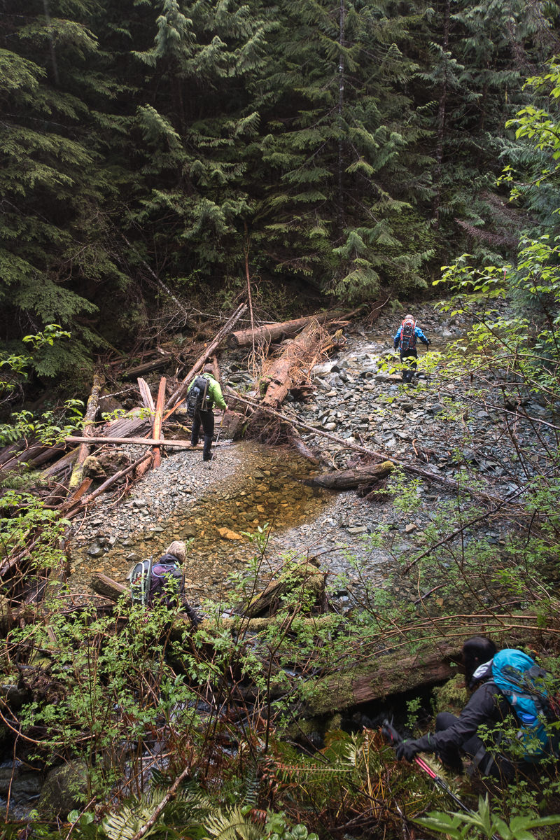
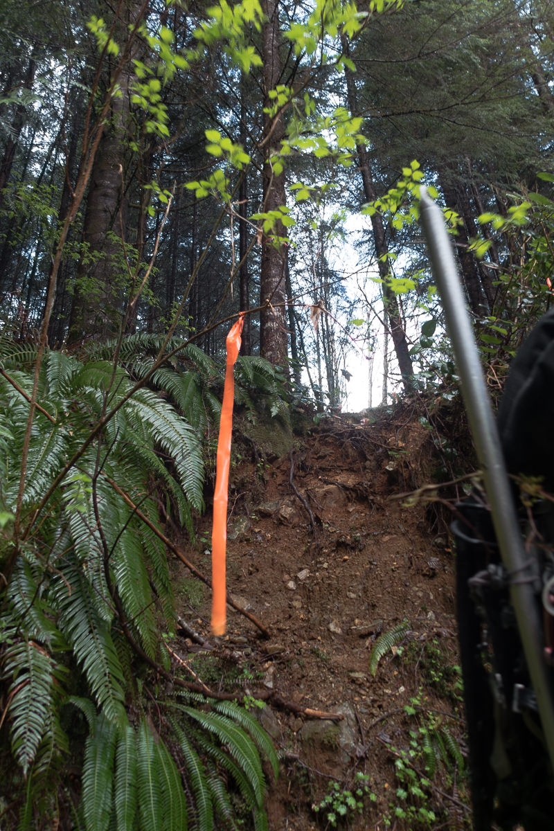
Despite my description, one shouldn’t approach this route expecting it to be a walk in the park. It’s uneven, challenging terrain that includes ascents up slippery rock, edging along steep slopes, a few low fifth-class root sections, and at least one long, crumbling gully–you know, typical Highway Four terrain. The earliest signs of spring were emerging in the swampy areas: the odour of fresh skunk cabbage permeated the air, and the still-skeletal forms of wild blueberry plants were decorated with buds that will soon burst into the colours of early summer. Yet, the still-flattened ferns haven’t recovered from the weight of winter’s snow.
We made slow yet consistent progress through the muggy forest. In just over two-and-a-half hours, we ascended from the highway (45m) to 850m, where the snow line started. The lowest section of snow bore no weight at all; with each step, Phil and I sank to mid-calf, and often farther, once up to the waist. We skirted the snow as much as we could, and within twenty more minutes of hiking, the snow improved enough to allow slow walking. We veered from the normal route, taking many shortcuts up to the lowest section of ridge, and our first view of the day.

a little root scrambling. Well done, Shannon!
While we ascended, we caught glimpses of blue through the trees; periodically, the sunbeams pierced the dense canopy to illuminate the ground below. However, by the time we emerged from the thicket onto the open terrain, we could see clouds racing us to the summit. At the first lookout, we could make out only the hints of the Kennedy River Valley, and the lake was obscured. In the other direction, we were given only a few minutes to examine the Mackenzie Range’s rocky peaks before cloud flooded in. But in those moments, we caught views of Redwall, Mackenzie Peak, and the many rolling bumps that make up the ridge. Only a moment later, the ridge and the immediate route ahead were obscured by descending cloud.

We plodded along, carefully keeping to the crown of the ridge. By 11:30 am, we were only about 400 metres away from the base of Mackenzie Peak, though still more than four kilometers from Canoe Peak. Somehow, in a short time, Phil and I had pushed well ahead of our friends; we paused to take stock of our situation, and wait for them to catch up. When Shannon, Colleen, and Rick arrived, they shared their issues: the pre-existing injuries were causing them extreme discomfort. One of them was at a 7/10! As if these issues weren’t enough, while we waited the clouds descended and shrouded the route ahead, obscuring our route and hiding potential falling hazards. It increased the situational risk, a risk we weren’t willing to take. Even though we were still hours away from our objective and nowhere near our turnaround time, we called it — time to head home!
Our descent was quick, and we were back at the car and changed for driving by 2:30 pm. The best part of the day was the celebration back at the cars, where Shannon produced some delicious fruit tartlets and we sang Happy Birthday to Colleen. Happy Birthday!
-

- fog!


-

- Spring is in the air


-

- a few choice gullies make the route fun and easy.


-

- forest chicken

-

- cloud rolling over the ridge

-

- Kennedy River Valley and Kennedy Lake from the lookout below the Mackenzie Peak


-

- the steady up, up, up route!


