My body aches, I have swollen feet, and the bounty of scratches across my hands and face sting as I make the long drive home from our adventure on Steamboat Mountain. A group of five Island Mountain Ramblers pushed through the wet bush that crowds the notorious Cavers Trail, a non-technical route which starts on Highway Four. My aches and pains solemnly remind me of the day’s failure – at least, my own — but curiously, I’m not dissatisfied with my effort and achievement, or the experience itself. Today, failing to reach the summit allowed for a unique opportunity in Vancouver Island’s alpine: a chance to walk on bare, water-sculpted, limestone features. The only sting I feel is the pang in my heart: I’m going to have to make a third attempt on this peak that my group renamed Steambush Mountain.

GPS Route and Map
View the route and see where I took my photographs.

Horizontal Distance 13 km

Starting Elevation 45 m

Maximum Elevation 1169 m

Total Elevation Gain 1275 m

Total Time: 12 h
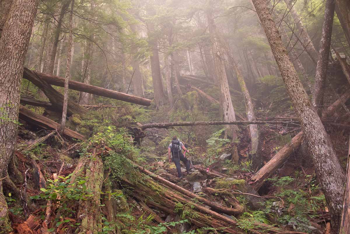
Earlier that morning, as we drove the long stretch of highway toward our destination, my eyes scanned the summits that make up the Maitland Range. Dense, low-altitude convection fog obscured the peaks, and fine mist congregated on everything it touched. Outside the cars, at The Zipline Attraction on Highway Four, I distributed radios and discussed the objective and the route. By the time we were done, the mist had gathered into large droplets on our cars, jackets, and backpacks. We started the day late, at 7:30 am, in conditions that guaranteed each of us would be soaked!
This was my second attempt at Steamboat Mountain using the caver’s trail; you can read my earlier attempt on Steamboat Mountain here. The summary of that first trip is simple: we ran out of time, and the snowy conditions turned us back. This time, my second attempt, was on one of the longest days of the year. Even though my first attempt was only a few months prior, I wasn’t emotionally prepared for the seasonal changes to the route: the warm spring conditions had transformed the region into a typical rainforest.
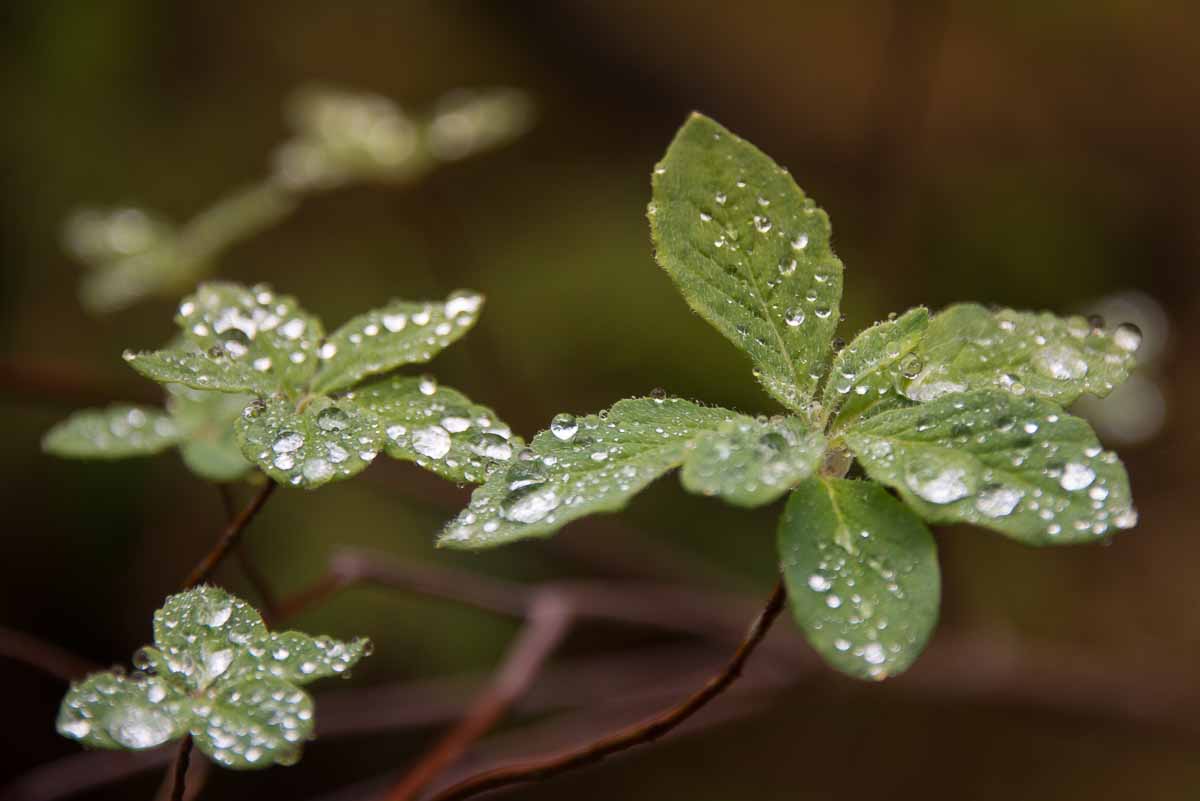
On my first attempt, the landscape’s predominant colour was the brown of dormant, decaying forest. Now, the region was a green, bushy thicket. Everywhere I looked I found new growth: fiddleheads, trillium, columbine, dozens of species of ferns and mosses; even the evergreen trees donned inch-long chlorotic tips.
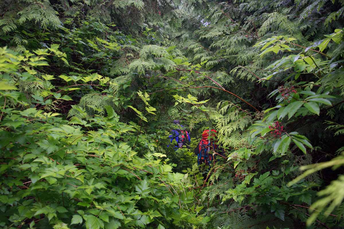
I’ve hiked some ridiculously bushy routes, including High Rigger Mountain, and a replanted section on the descent from Mount Tsable. However, none of these routes have the sustained intensity of the approach to the base of Steamboat Peak. Bushwhacking is generally classified on a standard six-point scale that assesses the intensity of the bush; it doesn’t observe duration.
I let the others lead, while I hung back in a futile attempt to stay dry. The boughs and leaves of plants slumped under the weight of accumulated water, brought by the evening rains and morning mists. As we walked through salmonberry, thimbleberry, and slide alder, the leaves shed their water onto us and within minutes, we were soaked. Travel is simple enough, but there is no way to avoid contact with the bush. We pushed through, stooped under, stepped over, and in many cases simply had to force our way through the thicket of bush.
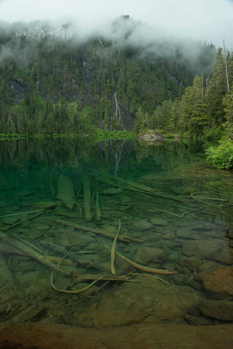
The route is not for the faint of heart: it climbs steep terrain and traverses crummy slopes as it works its way from the road up through Clayoquot Plateau Provincial Park and finally to the lake below Steamboat Mountain. The route is well flagged, and in some sections booted, but navigation is not easy–spotting the ribbons in the trees is a challenge. Despite the difficulties, we worked our way up the hill and crested a small hump before descending to the green-tinted lake (~840m). The lake was a crystal clear sheet of glass that reflected the waterfall and steep mountain cliffs of the opposite shore. The only disruptions to the surface were the gentle ripples created by three ducks as they paddled the lake. We stopped just long enough to eat our snack before tackling the final 500 metres of elevation to the summit.

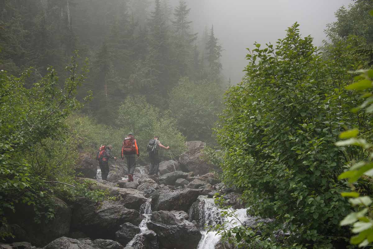
Unsurprisingly, we found more bush to navigate beyond the lake. We intersected, and then followed, a snow-fed stream which forms part of the route. We could see Steamboat Mountain at the head of the valley, but progress slowed as we crisscrossed the stream. We hopped from rock to rock and scrambled over large boulders, trying to keep our already damp feet out of the river–a futile task, as each of us would ultimately fall in at some point. Phil and Drew, who had done a great job route-finding up the creek, raced ahead of the group, and we lost track of them. We made an effort to route around a troublesome stack of boulders and wall of trees, but we were unsure of which way they had gone, and the boulders appeared impassable due to water flowing amongst them. Though we tried to raise the two on our radios, their radio battery was dead; we called after them, and waited for several minutes, but there was no response.
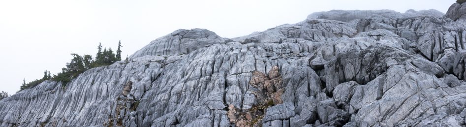
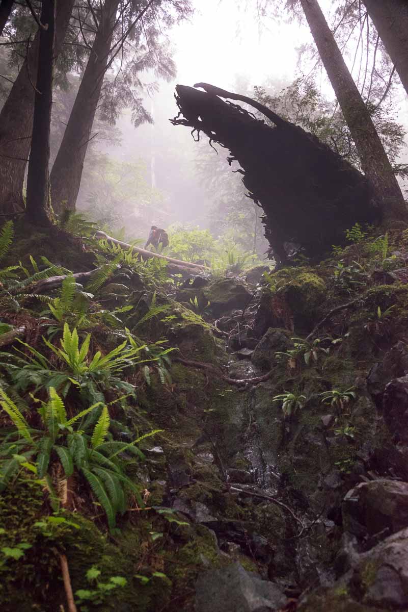
We tried skirting around the obstacles by using the hill on the west side of the stream. As we climbed, we could see that we wouldn’t be able to get back to the stream, so we set our objective to the ridge high above us; the topo maps made it look like a promising route. We climbed through the forest, clambering up slippery moss and sometimes using the sturdy alpine bush to haul ourselves up the steep slopes. The higher we climbed, the more limestone formations emerged through the dense forest floor–they looked like an alien growth bursting through the skin of its host. Though the terrain is steep, we gained elevation easily; we finally broke out of the dense forest at 1100 metres. Our reward stretched out in front of us: an expanse of exposed limestone features.
Steep limestone slopes billowed up the side of the mountain, forming multiple terraces as they rose toward the summit ridge. From afar, we could see dark lines that looked like veins running down the pale gray surface of the limestone. It looked as though the limestone pillowed between each line, but as we reached the slopes I could see that the surface of the limestone was flush, and the deep veins were flutes created by centuries of running water. The pillowed look was nothing but an optical illusion. We stood staring for several minutes, and poked around the closest limestone features. Although the stone looked smoothly sculpted, it was hard and unforgiving.

We climbed short sections of the feature easily, but I noted its hazards. The rock was incredibly sharp, and as I climbed the long flutes, I cut the palm of my hands, despite taking great care with hand placement. As I stood and looked at the foreign landscape, I had a rare moment: I was concerned about tripping and falling. Any fall, even a short tumble, could result in a limestone spike through the chest, head, or hand. The region is breathtaking, but threatening!
We were only 100 metres in elevation from the summit ridge, which was still shrouded in cloud, when we decided to turn around. It was obvious that we wouldn’t make it to the ridge and traverse across to Steamboat Mountain’s main summit before our turnaround time. I looked to the hidden summit and imagined that Phil and Drew must have already reached the summit and would soon be turning around.

The three of us reluctantly descended back along our ascent route, leaving the limestone behind us, unexplored. As we descended the stream, we walked through the knee-deep waters to save time and avoid the slippery rocks on the edge of the creek. Although I was disappointed at a second failed attempt, Beth was chipper, and she cracked jokes as we walked amongst the boulders of the stream. We reached the river and worked our way back to the lake, walking through the rushing waters. A few minutes down the river, we heard Phil and Drew catching up to us; they had reached the summit with little effort, and had a great story to tell. It was frustrating to know they had easily reached the summit after the short rocky section we couldn’t climb over.
The return to the car was a wet, slippery, but otherwise quick affair. Each of us had our own mishaps: Drew did a header off a log that crumbled below him –fortunately, his neck broke his fall; I slipped on some mossy rocks and did a butt-slide down a 15-foot trench –good times! Nevertheless, we made it back to the car relatively unscathed.
As we crossed the Kennedy River to reach our cars, we looked back to Steamboat Mountain–patches of blue sky poked through the clouds, and the peak was easily visible.
The prospect of hiking this route a third time doesn’t thrill me. It’s not getting less bushy, less slippery or any less high. But, I will do it again. I must do it again. It’s part of my Island Alpine Quest. If you are looking for a beautiful mountain lake to have all to yourself, and you’re not afraid of a little bush then consider checking out this route.
Comments
Pingback: Steamboat Mountain: A Walk on Fluted Limestone - Island Mountain Ramblers