
I had an incredible summer full of back country adventures in the mountains, and on the ocean. With the summer well behind me I’m back at work waist deep in students and the daily grind of the job. Adding insult to injury, I’m a student again, retraining myself in the ways of research and writing. I have not forgot the summer, how could I? I still have thousands of photographs to process and a few key adventures to write up.
In late august Ryan Bartlett and I hit the trail, finding adventure in the hearth of Strathcona Park. Cream Lake and the surrounding mountains played host to us for this three day trip. Together, we have a habit of long mountain days. An unspoken goal is to cram as much adventure into the limited time we have –we frequently hike sun up to sun down. This trip, we didn’t achieve all our goals but we found plenty of adventure and summited a number of peaks in the area: Misthorns, Margaret Peak, Big Interior Mountain and a close call on Mount Rosseau.

Total Horizontal Distance: 56 km |
| GPS Route and Map with Photogarphs |
We accessed Cream Lake via the standard route, following the BC Parks Trail past Baby Bedwell Lake and Bedwell Lake. From Bedwell Lake simple route finding is an asset as there are a variety of trails that start at or near the lake, including: The Bedwell Centennial Trail , a route to Mount Tom Taylor, and the trail that leads past Little Jim Lake to Cream Lake.
The Bedwell Lake Trail is exceptionally well developed . It includes hard packed trail, well-planned switchbacks, boardwalk and, in the stretch between Baby Bedwell and Bedwell Lake, metal stairs and railings that make travel quick and easy.
 |
| Ryan crossing the suspension bridge on the Bedwell Trail |
 |
| First view of the Big Stuff, hiking the Bedwell Trail. |
From Bedwell Lake the trail ends and the well-booted route begins. Areas were the route diminishes, cairns mark the path but some simple route finding may be an asset. On our way to Cream Lake we were looking for the lower route to Big Interior Mountain, so we turned off the main trail on a route but backtracked when the route was bushy and time consuming. We wouldn’t make the summit of the mountain and out to Cream Lake before nightfall. We set our day’s destination as Cream Lake.
 |
| Big Interior Mountain as viewed over Bedwell Lake |
The hot dry day was punishing. As we walking alongside Little Jim Lake, it was all I could do to not strip my clothes off and jump in the beautiful clear waters. We stopped only momentarily to get water and admire the crystal clear lake. From Little Jim we walked through the large boulder field and stayed to the left on the route to Cream Lake.
 |
| Little Jim Lake |
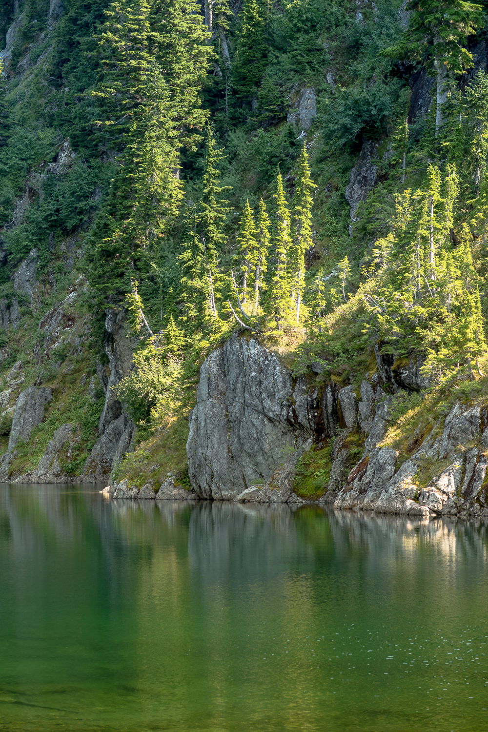
The first view of the lake is breathtaking. The mineral-rich turquoise waters peek through emerald green branches of the conifers hinting at what lay beyond. We paused as the lake became visible and captured some images. We made camp at the lake, enjoying the view of Flower Ridge and the route up the Septimus Glacier to the West Ridge below feature known as the Citadel (a feature of Mount Septimus).
 |
| Cream Lake through the trees |
The next morning it was still twilight as we started walking but we had a long day ahead of us. Because our planned routes were class 3 and 4, we didn’t bring ropes and our packs were light. We carried our cameras, first aid,crampons, mountaineering axes and our lunches. As we approached the Septimus Glacier we were in awe of the condition. At first we thought that it was almost gone but upon closer inspection we could see the ice hidden below large deposits of small and large rocks; likely exposed as the glacier rotted away. We were careful as we climbed the glacier, there are many crevasses, moulins and areas that are so rotted that the rock below is exposed. Due to Ryan’s love of glaciers we moved slowly, we made the ridge within 2 hours of our start.
 |
| Ascending the Septimus Glacier from Cream Lake |
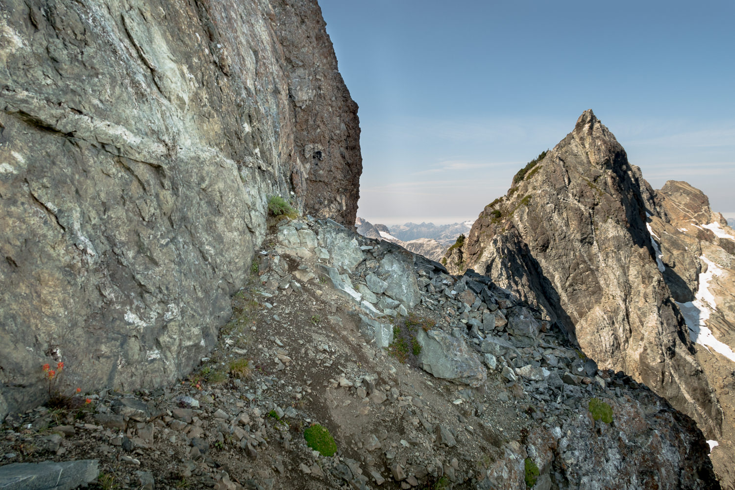
Before descending the southwest face we admired the view. The west ridge gives a spectacular view of Love Lake in the circ below; the long ridge of peaks we were seeking today; and to the southwest, Della Lake nested below 9 Peaks with the majestic Della Falls descending below the Lake. As we descended we traversed the long choss slope below the ridge of mountains on our left. The slope was devoid of snow, thanks to the poor winter and hot dry summer. We walked along the slope to the crest that leads over to Margaret Glacier. It’s here that we stopped to take stock of the day’s options. Our hopes were for Mount Rosseau, The Misthorns and Margaret Peak. We wouldn’t achieve all our goals.
We examined the south face for a route that would give access to the long ridge of summits. Our beta gave us the route described in both Philip Stone’s books however many of those routes follow low 5th routes and we wanted to avoid that; Margaret Peak has an easy class three route that take you up to the ridge but we were skeptical about the span between Margaret and The Misthorns. We we were convinced there must be a way! As we looked between Rosseau and The Misthorns we noted that there was a line of greenery (the greenway) that traverses below the start of the Rousseau’s South Gullies route. We took a risk and approached.
 |
| Misthorns on the Right |
As we approached the greenway, it revealed itself to be broad ledge, an easy class three route up to the col between up the greenway. The most challenging section was at the very start, a narrow short gully with a rock that you need to duck under or scoot around. The entire route has minimal exposure and is easy to traverse greenery and easy to walk scree. It emerges in a deep col on the left of The Mistrhorns.
 |
| Ascending the greenway, not much exposure |
 |
| From the greenway looking down on Margaret Peak and Margaret Glacier |
We decided to hit up The Misthorns First, seeking the highest bump. We started up the rock and trees that make up the first section. There is a short 3 metre section of class four over good rock, there is some exposure so if you attempt this route you should be confident with foot placement. As we came out at the base of the first bump we split up. Ryan took the right hand side (south face), I went left (around the left to the north). The left route traverses a wide sloping ledge that follows around the bump to north face. For the most part it’s easy walking with one section that requires you to scale a 2 meter section of rock to another ledge. From the ledge it rounds a corner to the snowfield on the opposing side of the mountain (I think this joins the a route up from Green Lake side of the mountain). I stayed off the snow and walked under a giant slab of rock to a gully, this is where Ryan and I rejoined.
 |
| The airy step with 4th class down climb to Misthorns |
 |
| The route around the bump to the north side, a wide ledge |
We descended onto the snow, and followed this to the dip dip between the two bumps. From this dip it was an easy class three scramble to the summit. This is Ryan’s second visit to the Misthorns, he insisted that he did a different peak on his first trip. However, I found a glass jar inside the cairn that contained a slip of paper with his name. From this high point we examined the other peaks and the remainder of the ridge leading to Margaret Peak. We were not willing to take on the challenge and turned back to attempt Rosseau. We followed my route back to the col between the two peaks, Ryan told me that my route was more challenging than his because of the 2 metre down climb. A perfect illustration of how different folks are comfortable on different types of terrain.
 |
| Ryan down climbing the short step down, north side of the Misthorn bump |
From the col we maneuvered along the south face to a ledge leading to a steep third class slope covered with crowberry, shrubs, and rock. The angle of the slope exceeds 45 degrees at times, increasing the exposure. However, there are a lot of good handholds and though the scramble down was not fun it is easily doable for those with the experience.
We scrambled higher, to what I thought was the top, traversing the south face below the massif but something wasn’t jiving. My GPS placed me within 30 metres of the summit but I could see that I was very obviously NOT on the summit. I scrambled up to this high point (1953 m) to see if there was a register, there wasn’t. I sat on the rock examining my map, GPS and looking at the terrain. It was difficult to judge my position. The true summit looked far away, definitely farther than 30 metres, and the terrain looked difficult, more difficult that what we mustered already in the day. We decided to turn back and head down the greenway. (Note: When I got home and examined my data and did more research, I discovered that I was only about 30- 80 metres from the summit, literally the last stretch before the summit. I’ll have to catch this one the next time in in the area)
 |
| Standing just before Mount Rousseau! So close. Septimus’ North Glacier pictured on the right. |
Once down on the choss slope below the greenway we descended to the solid rock that leads to Margaret Glacier, before crossing on the slab rock to the obvious route up to ridge. The ridge provides obvious access to Margaret Peak. Though we started up the steep slope to the summit I recommend walking around to north west face, stay low as you round the main summit and eventually an easy route will become visible, simple class two hiking to the summit.
 |
| The ridge leading to Margaret Peak |
We sat on the summit at (1863 m) and enjoyed the view of the mountains around us. We noted the time 4:30. We decided to descend and head home along the route we followed in. On our way down the Septimus Glacier our biggest concern was sliding rock. The heat of the day caused ice to melt, and set large, nay very large rocks sliding down the slope. We avoided walking in areas where large rock sat on ice and stayed alert as we descended.
 |
| The view from Margaret Peak, the long ridge leading to the line of peaks. |
We arrived back in camp at 8:30 pm, the light was disappearing as we arrived. We noted several tenters arrived while we were hiking. We greeted each other, however, with the setting sun, fatigue of the day, and anticipation of an early departure the next morning, we didn’t chat long.
 |
| Ryan loving his glacial moments |
Our big plan for the final day included a detour to summit Big Interior Mountain and then a return to the car. We made our way to the large boulder field before Little Jim lake, and stowed the heavy contents of our backpack behind a large boulder before heading south. From the boulder our route is visible, a gully that leads to the ridge above.
 |
| Ascending the slope to the ridge which leads us to Big Interiors’ Glacier |
We used the route description from Hiking Trails Three and discovered a lightly marked route. Following this we detoured from the route in the book, and though we were able to get to our destination following mostly class two and a little class three it cost us time. We walked on top of the ridge until we came to the top of the Big Interior Glacier, route finding was required to navigate along the solid rock and up several features.
 |
| typical granitic rock terrain, mostly simple class 2 |
We wore crampons to descend the gentle slope. The glacier was in poor condition, The walk down was time consuming because of the surprising number of shallow crevasses. There were many that we had to jump over as there was no way around.We kept to the north edge of the glacier, as the crevasses were easier to navigate. At the bottom we continued to our left (south), making our way to the rock which wraps around to the north face of Big Interior Mountain.
 |
| Big Interior Glacier, melting before our eyes |
 |
| Looking north to the Big Interior Glacier
|
My understanding is that up until a few years ago, an extensive snowfield/glacier wrapped around Big Interiors sub peak and base of the summit. As of last year large sections of it have melted away, exposing steep rock covered in glacial flower. Deposits of the powder-like substance are deposited on the rock slab that we climbed on the way to the summit. The route up is a matter of picking your way, many different options are available, we stayed low and worked our way up the scree. Right at the ridge the route gets a bit steep but we were able to find a class three route to the top.
 |
| The long climb along slab rock to the summit of Big Interior Mountain |
At the col between the two peaks the route is simple hiking to the summit, another choss pile. As I approached the summit I was hailed from above. Two men were standing on top. As I walked the last few meters one of the looked at me and queried, ” I’m going to guess that you are Matthew?”. As it turns out we met on a hike earlier in the year, up 5040 in February. It’s funny how many people you meet in the as-close-to-the-middle-of-nowhere-as-you-can get on Vancouver Island.
 |
| 9 Peaks as viewed from Big Interior Mountain |
Ryan tailed behind me a stretch, so I set a while and enjoyed the sun and enjoyed the views. When Ryan arrived, we ate our lunch and descended back to the glacier. Knowing the route we followed in was not the standard route, were looked for an alternate route where we wouldn’t descend to the circ far below the glacier. We hiked over lip of the glacier to the north edge and onto the rock shelf. I won’t be too specific here, the route is convoluted but rest assured there was little in the way of exposure and only a few easy class three sections. We eventually rejoined the route we came in on and walked the final few kilometres back to the gully that started the adventure.
 |
| The worst of the class three on the return to Little Jim Lake |
The round trip took much longer than anticipated. We expected it to take us 5 hours and we were 8 hours return to our gear. We knew our walk to the trailhead would be quick but we also knew we would be making those last steps in the dark.
Of all my trips this summer, this one is near the top. Adventuring into new regions and adventuring without a predetermined route to follow is a great experience. I often think about the original surveyors in Strathcona and wonder what it was like for them as they literally made the routes that future generations would use.
View full album with ra images of this route…