 |
| GPS Route with photographs |
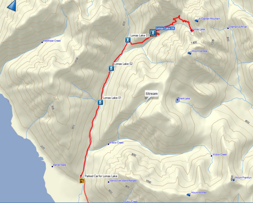
Total Distance: 21.9km
Max Elevation: 1189 m
Total Ascent: 1678 m
On Saturday July 5th, six hikers, many members of the Island Mountain Ramblers, rendezvoused in Ladysmith outside Coronation Mall. After fueling up on coffee and meeting with each other we listened to the hiking plan and objectives before then head toward Youbou. Our first destination was the trailhead located at Cotton Wood Creak East Logging Road.

The day was beautiful, full sun, with only a few white puffy clouds to keep the sun company. The hiking temperature was wonderful, though it was full sun much of the hike was in heavily treed area or in the shadow of the surrounding mountains. Even though the ascent was relatively strenuous the hikers were able to keep their temperatures down.

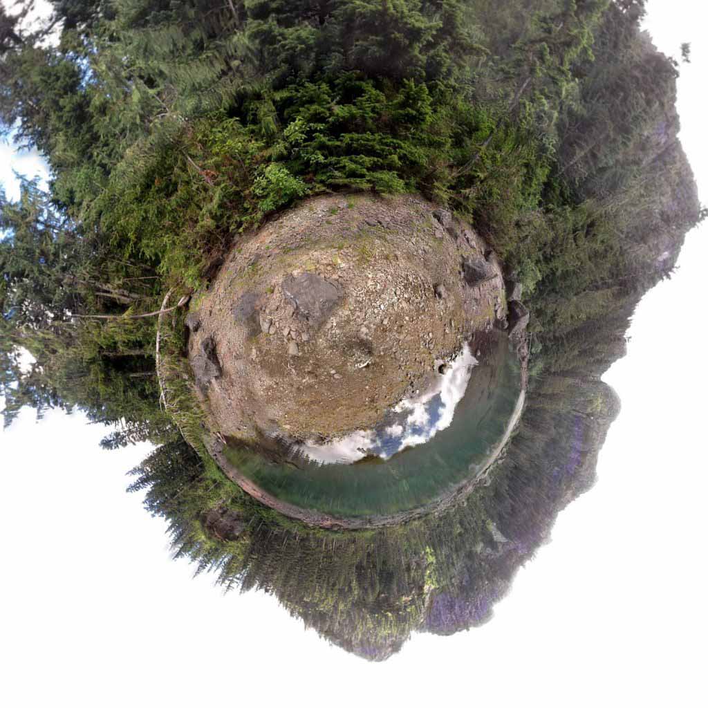
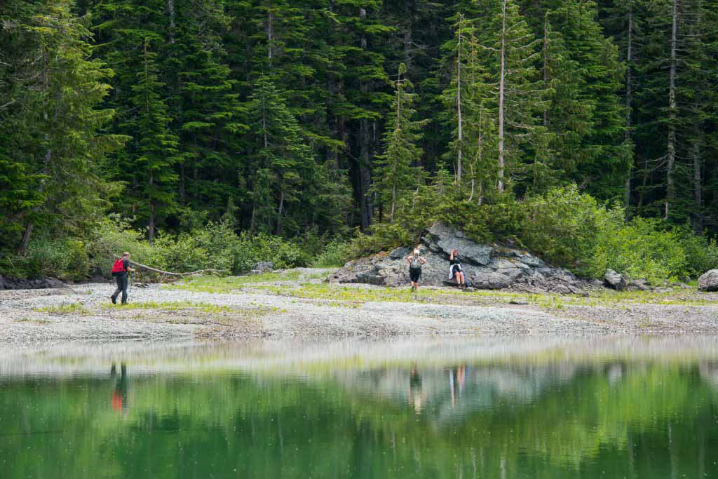
We took our time, picking our route and taking a few opportunities to admire the views of the valley we were ascending from. Though the path is relatively obvious, there are one or two areas where we could have been lead astray, had we not been paying attention. We reached the gorgeous green lake in four and half hours. Lomas Lake is excellent! Even though it’s nestled in a bowl between the mountains we were graced with the good fortune of having full-sun on us as we ate our lunch. A few people even dipped their feet in the shallow cold waters of the crystal clear lake.

I was in a hurry to get back to Nanaimo for a social function, therefore we didn’t do much exploring of the area. Somewhere in the area there is a route that travels up El Capitan and Mt Langdale which Peter and I discussed as trip to summit either peak. We started our descent of the trail around 1 pm. The sun had moved providing previously shaded areas with more sun, giving us the warmth of the afternoon sun as we wound our way down the mountain side.
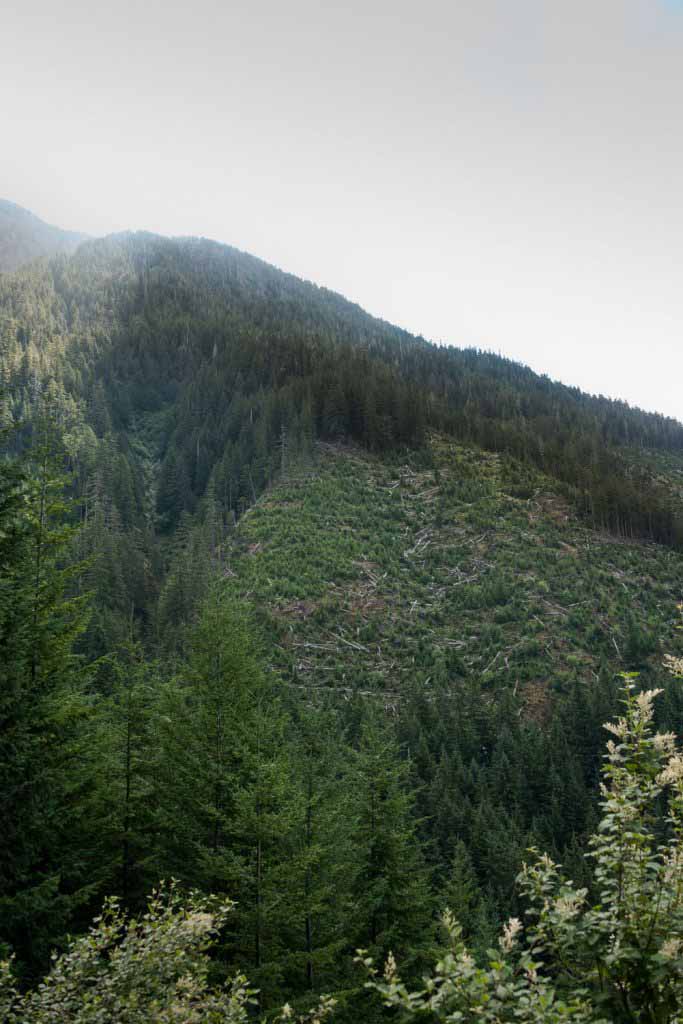
This hike travels over four types of terrain: active logging road, deactivated logging road, trail through former cut blocks and first growth forest. For the most part the trail is easy to follow, there are a few areas that require taking forks in the route– I have marked those in the GPS route with a hiking symbol. The trail on logging road and deactivated logging road is good, as is the route through first growth forest. Unfortunately a portion of the trail does head through old cut-block which is increasingly populated with alder. In many sections the it’s grown up and encroaching on the trail, obscuring the path slightly and making it impossible to not brush up against branches. We were able to pick our way through the trees relatively easily as there is a great number of flagging tape marking the route.

This trail is in need of some maintenance. It is clear that this route does not see a lot of traffic and I fear that if some trimming through the old cut-block is not done that the route will disappear into the alder. THis would mean the only way up to Lomas would be a bush-bash. For now though, the route is easily doable. The hiking group discussed the possibility of hosting a trail maintenance day. I suspect a group of 10 people equipped with trimming gear could trim the trail back in 4-5 hours.
Accessing Trail Head:
Cottonwood Creek East Logging Road Trailhead:
Take BC #18 west to Youbou, the turnoff is located just north of Duncan. Drive through Youbou, past the mill and down the logging road. The trailhead is located about 2 km down the road just after a small bridge. Parking is available on the side of the road. Follow the Cottonwood mainline, located behind a gate to the north.
References:


.
Comments
Thank you for this!
You’re welcome, Zach. Did you manage to find the lake?
I did indeed. Spent an incredible two nights there. For those interested in doing it, it is a fairly serious hike that only gets steeper as you go farther along toward the lake. However, the beautiful water, and secluded spot surrounded by cliffs is quite worth it.
Did you manage to get up El Capitan , Service or Landalt? Did you know there used to be a cabin there!